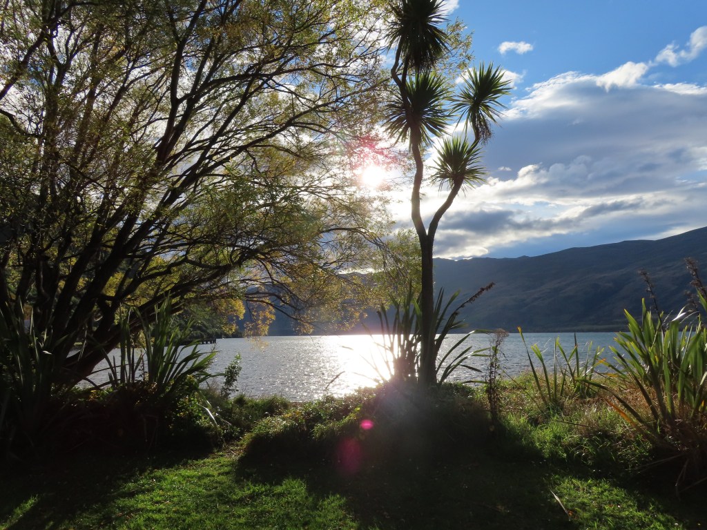
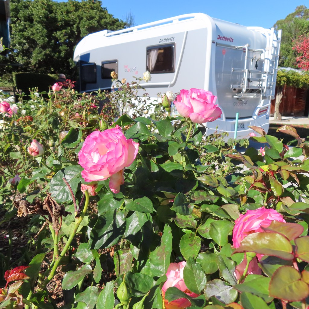
Bruce and Judy Philpott live at beautiful Flaxmill Bay, on the Coromandel peninsula of New Zealand. Whenever possible, they load the motorhome with their precious schnauzers Oscar and Hunter and go away from home to explore this beautiful country we live in
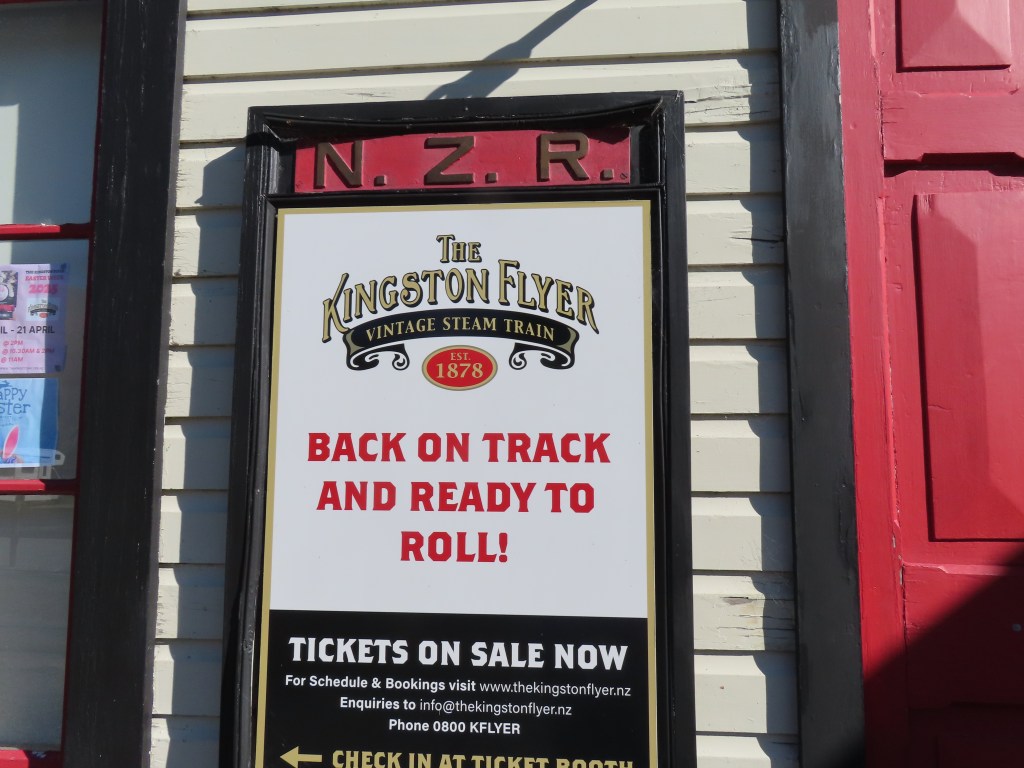
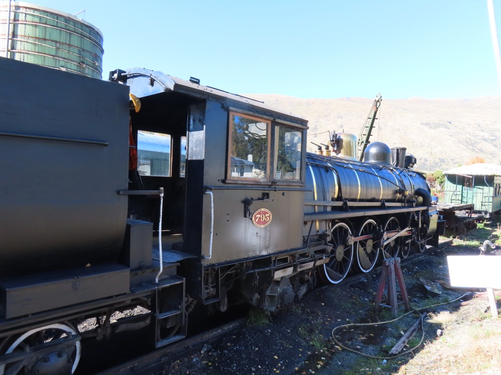
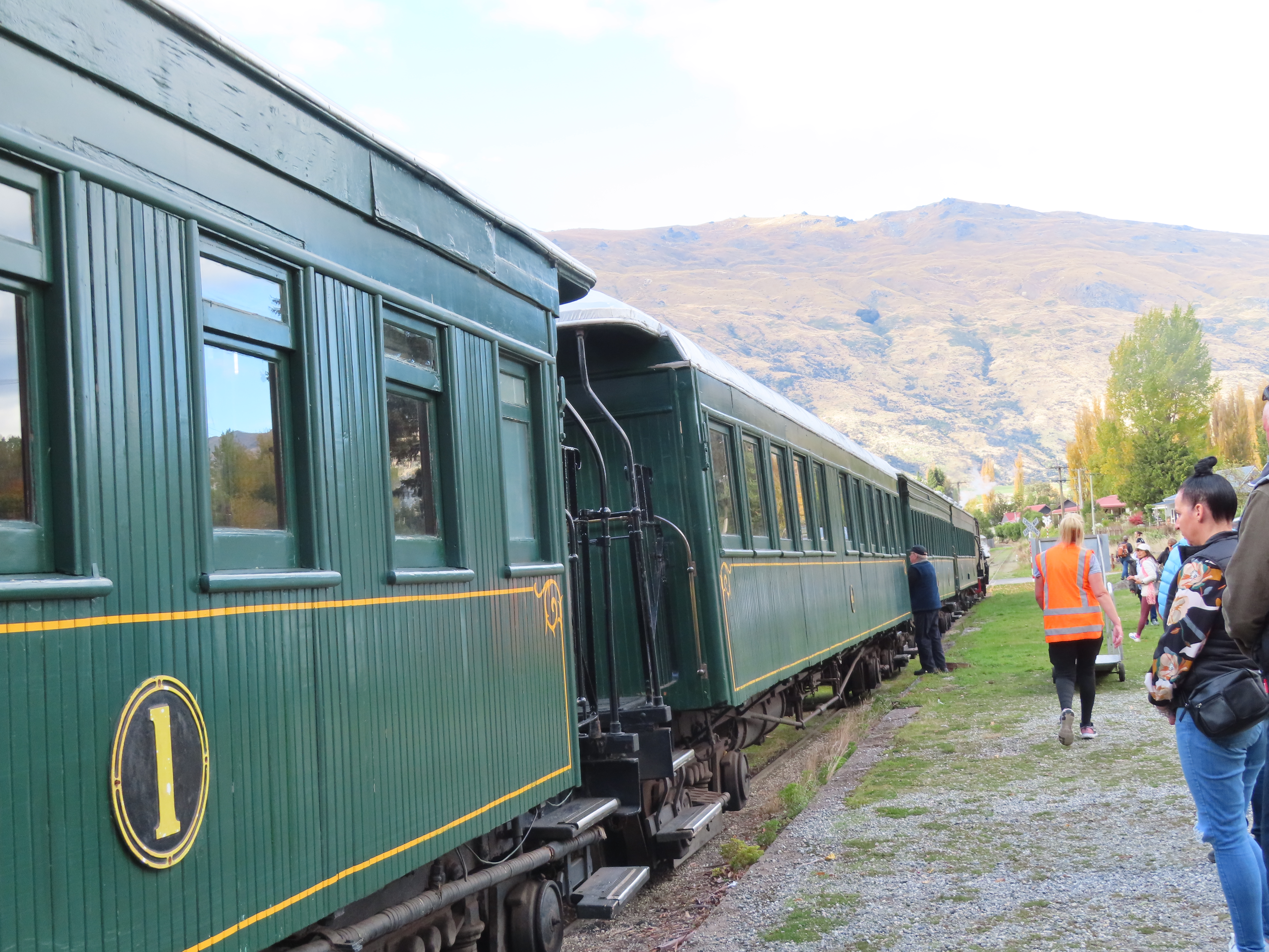
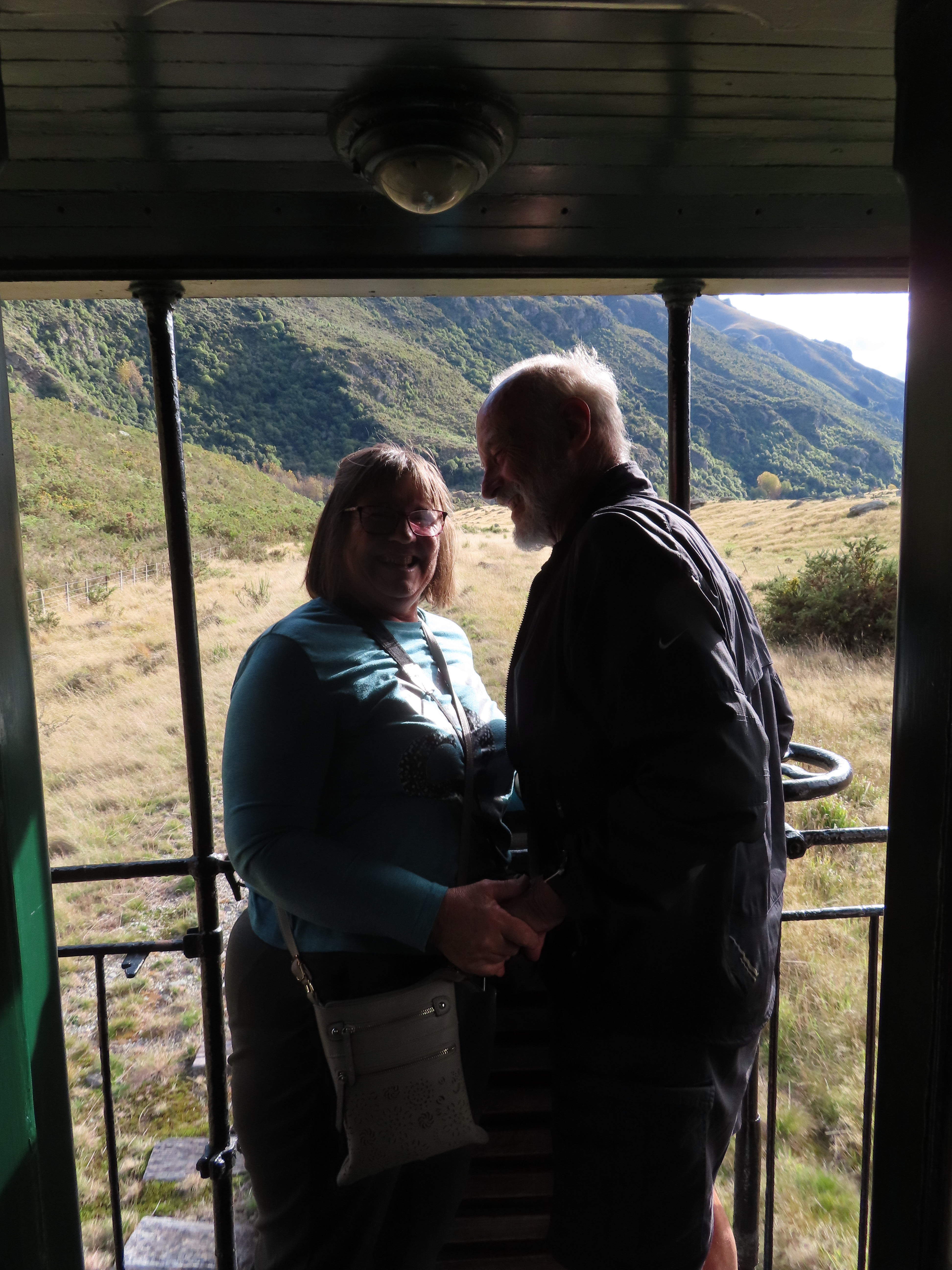
We had a train to catch – but not just any train – The Kingston Flyer was the train, and she only travels on a Sunday!
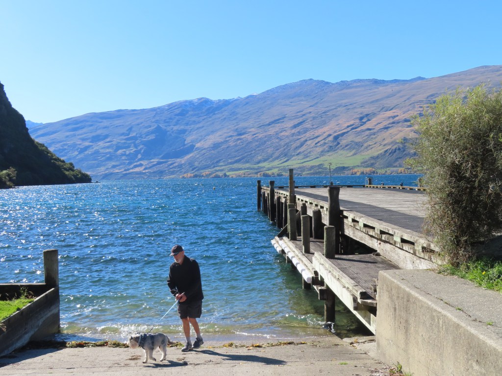
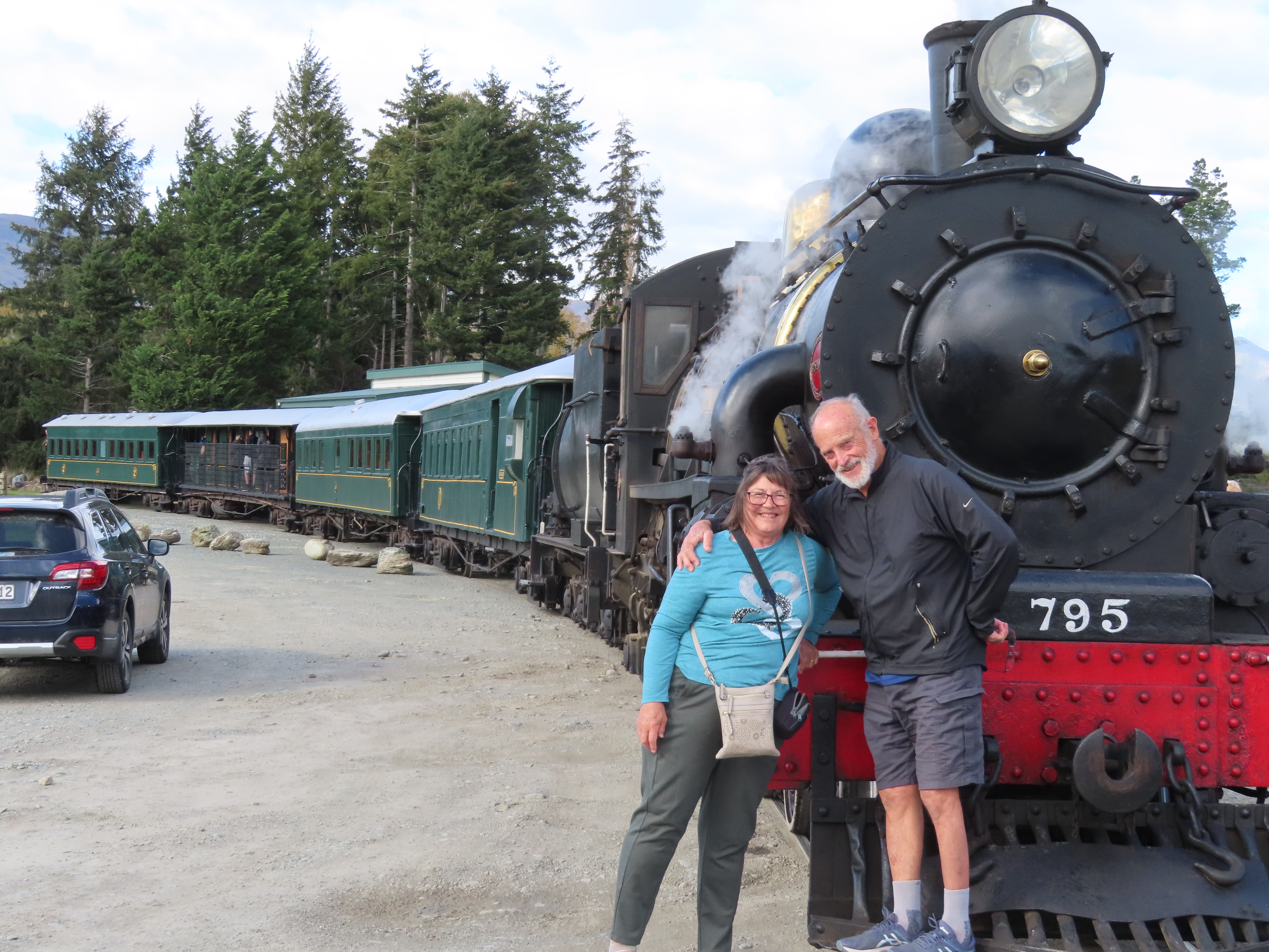
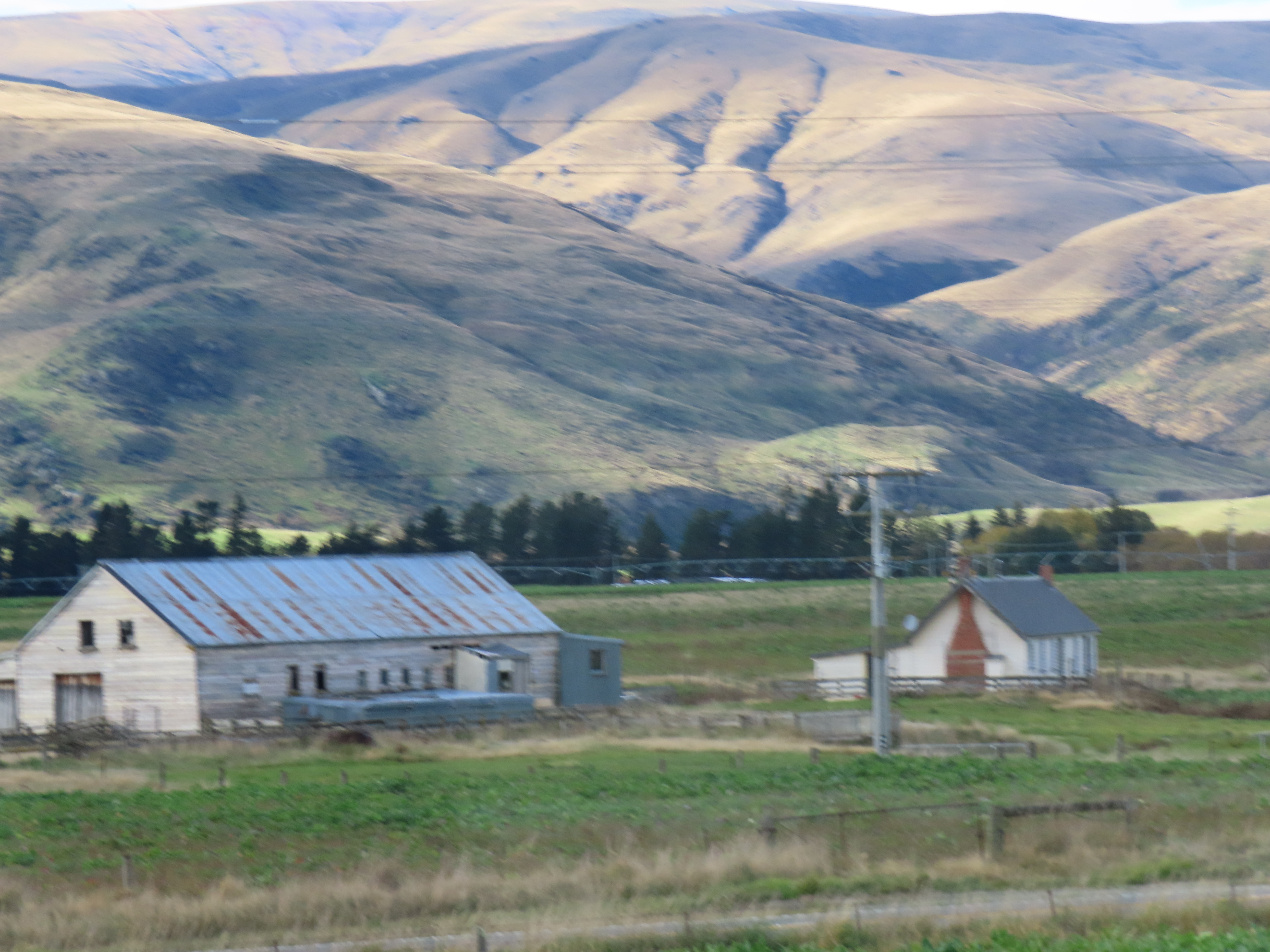
The Kingston Flyer came into service in the late 1890’s, running between Invercargill, Gore and Kingston. For those of you who don’t know, Kingston is a town right at the bottoem end of Lake Whakatipu, and only about 20km from Queenstown.
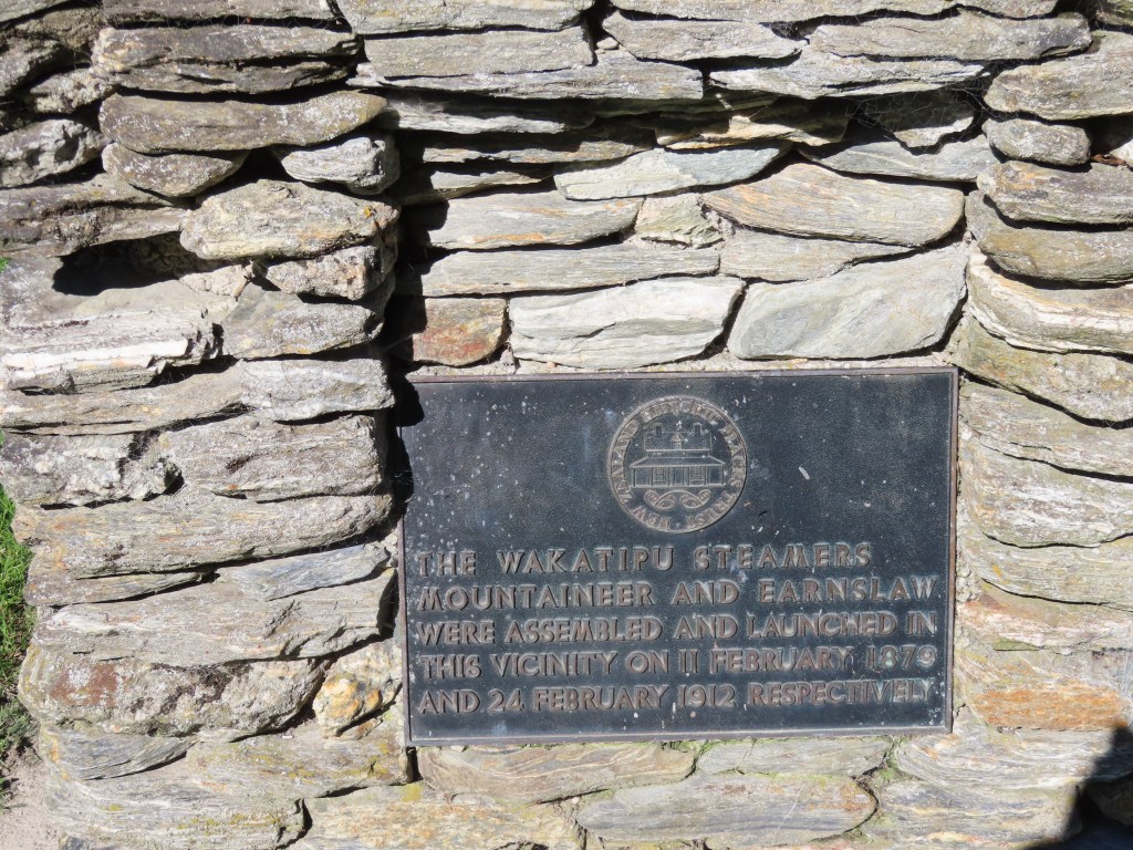
It was the Kingston Flyer that brought the ship the Earnslaw, to Lake Whakatipu, where it was launched.
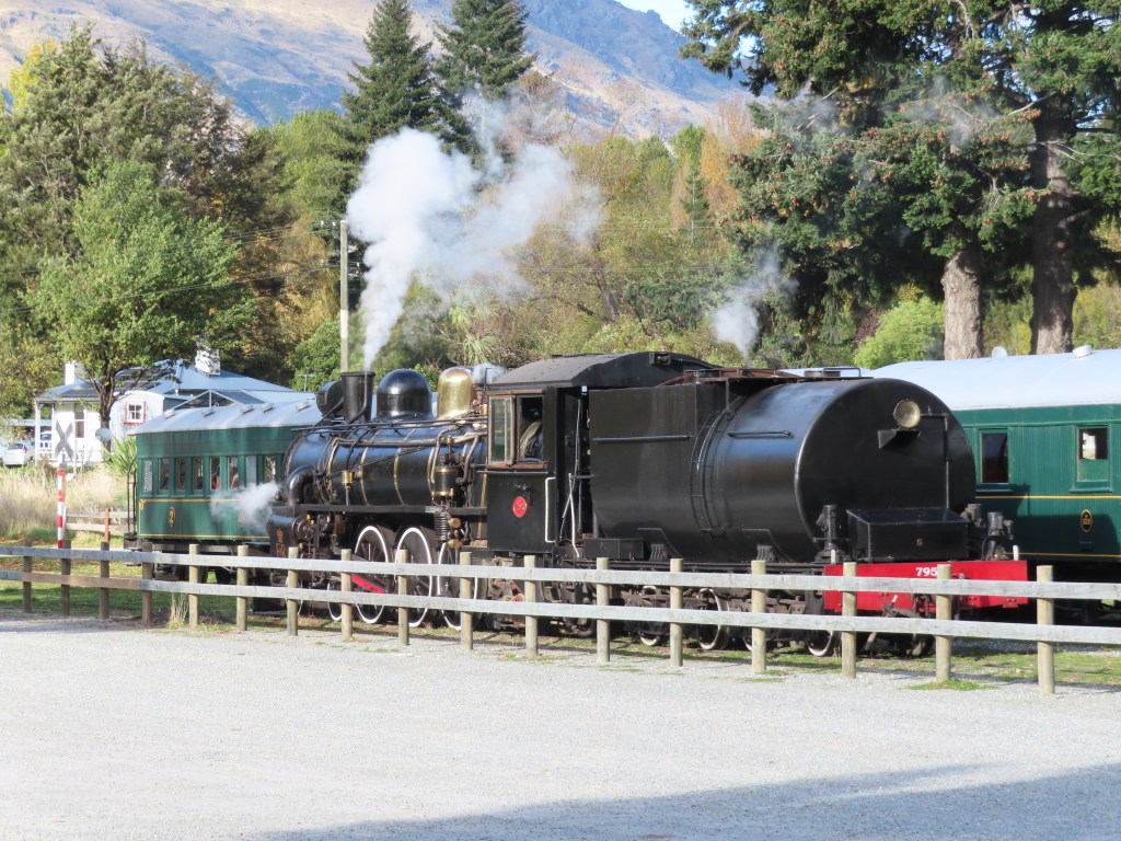
The regular runs of the Kingston Flyer ended in 1937 before stopping altogether at Easter 1957. In the 1970’s it ran as a tourist venture between Kingston and Lumsden, but that finished in 1979. The venture was eventually taken over by locals and now runs a return trip to Fairlight (about 30kms return) twice each Sunday over the summer.
She really is a beautiful machine.
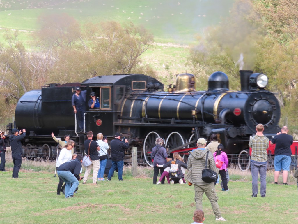
On each trip to Fairlight and back, she burns 8 tonne of coal (all shovelled into the burner by the fireman) and 28,000 litres of water.
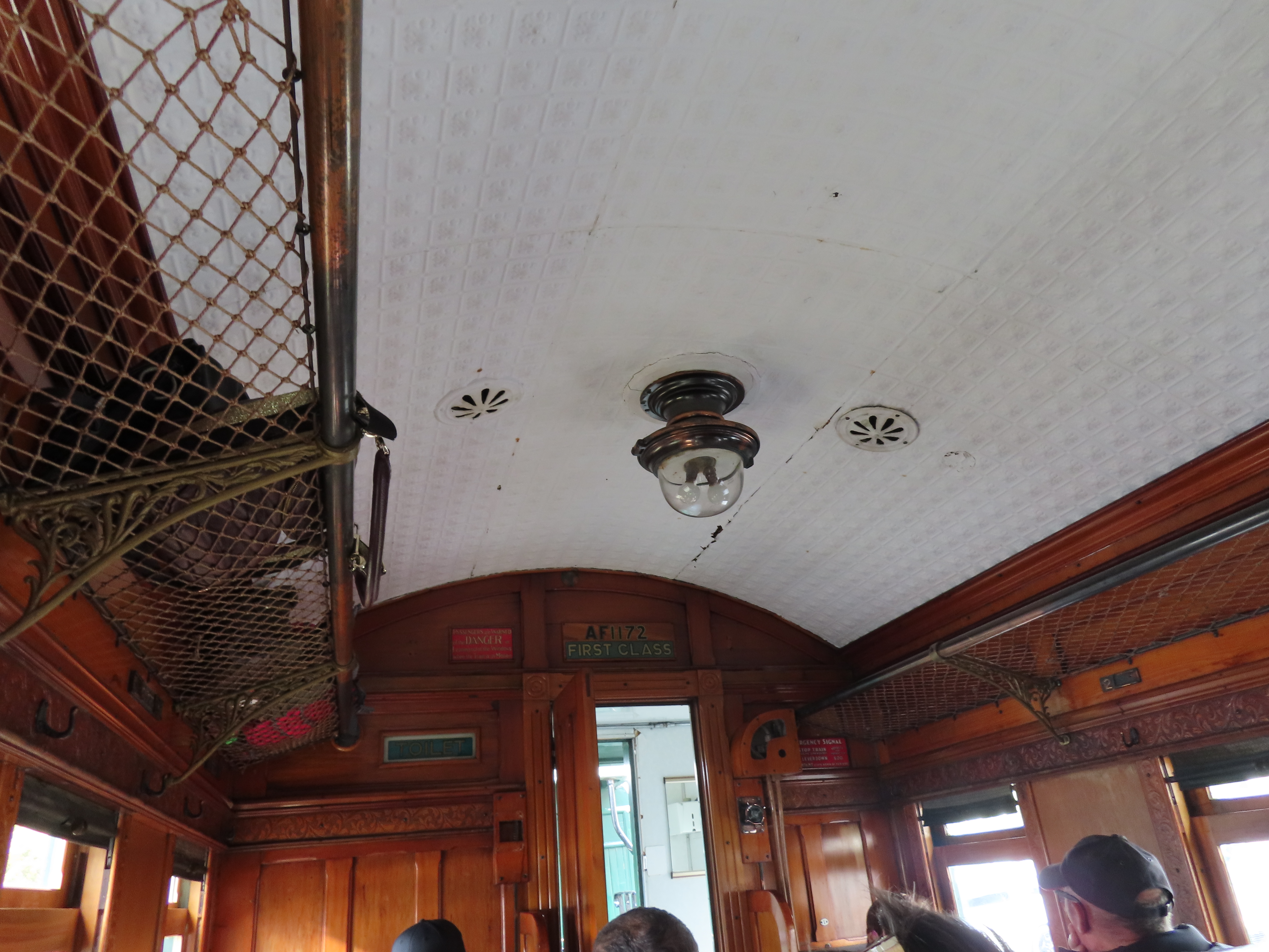
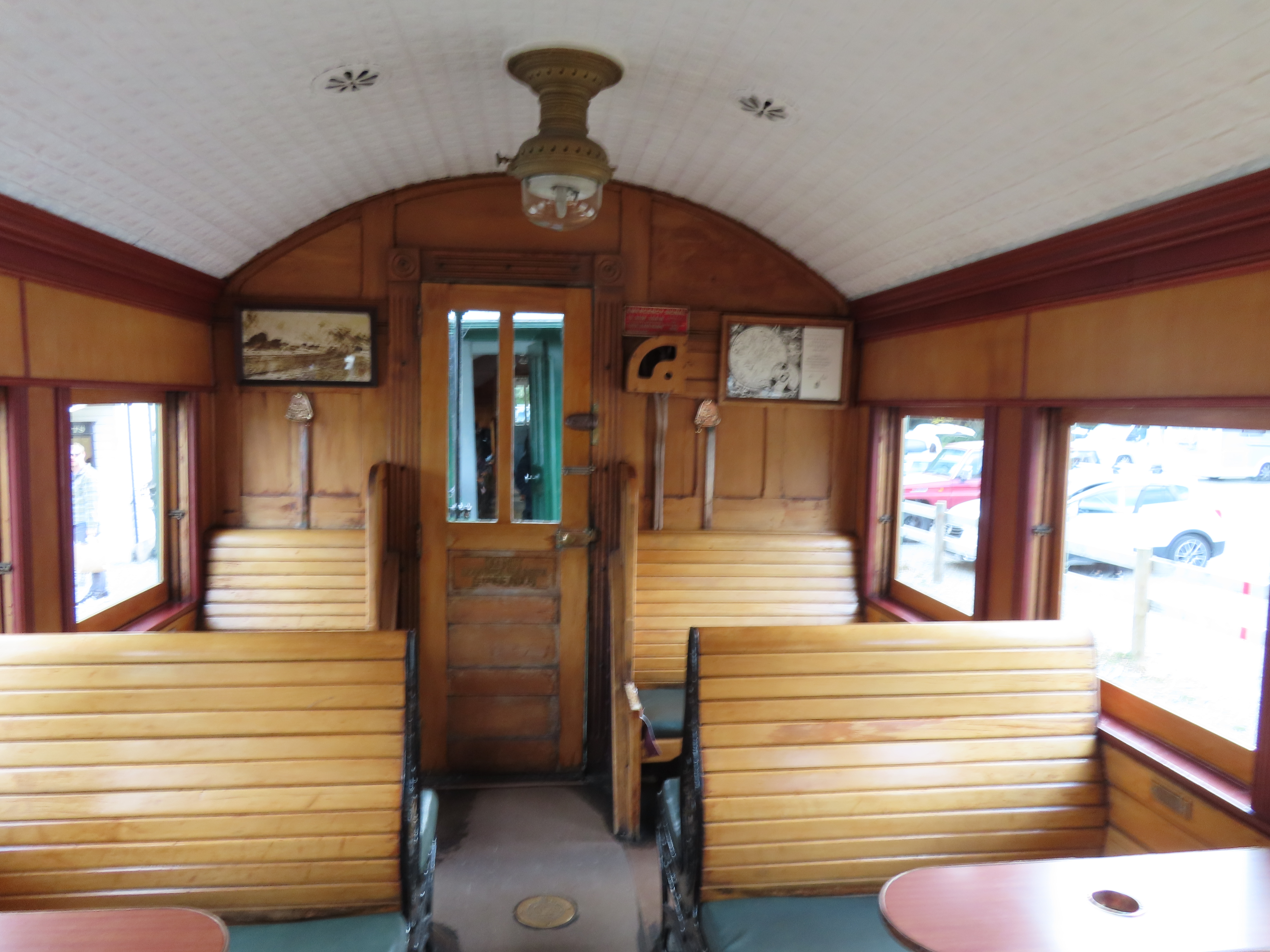
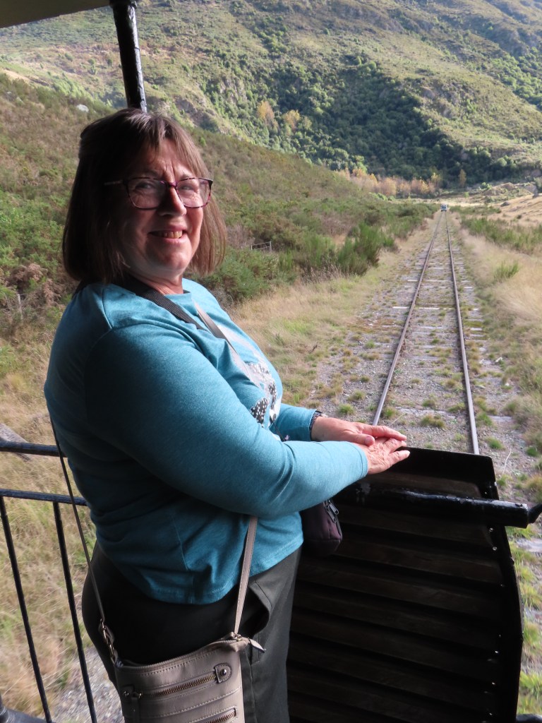
When it was time, Bruce and I took our seats in what was once the first class carriage. Some of the carriage really needed a bit of tender loving care, but overall it was very comfortable.
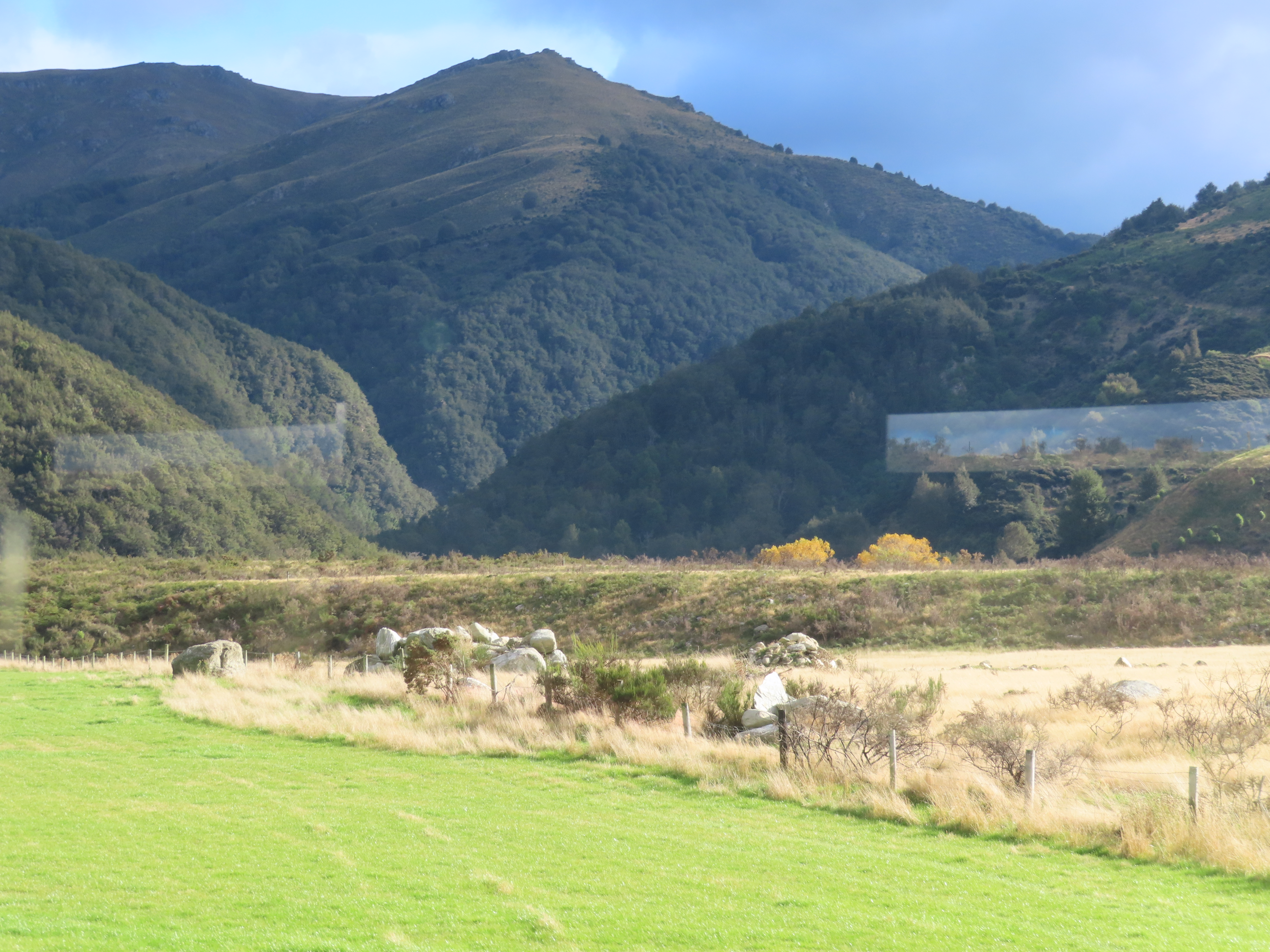
We enjoyed the scenery outside the windows. Apparently the train can go 120kph but on this trip its top speed was about 35kph. For a lot of the trip we were trailed by a firefighting truck in case the sparks emitted by the train inadvertently started a fire.
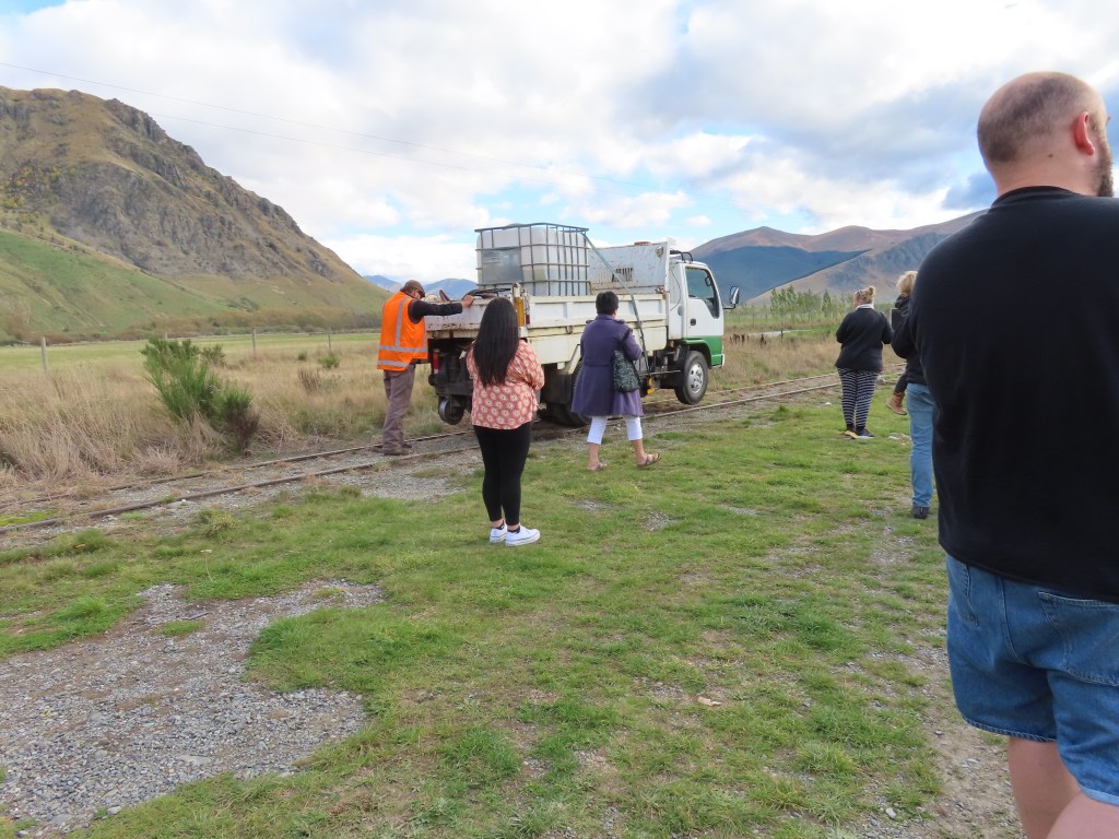
When we got to the Fairlight Station, the train had to be turned around, and part of that process included a race between children and the train across a paddock (all kept safe by fences).
Overall, it was a pretty special trip.
After this trip we headed further down the island to Lumsden for the night.
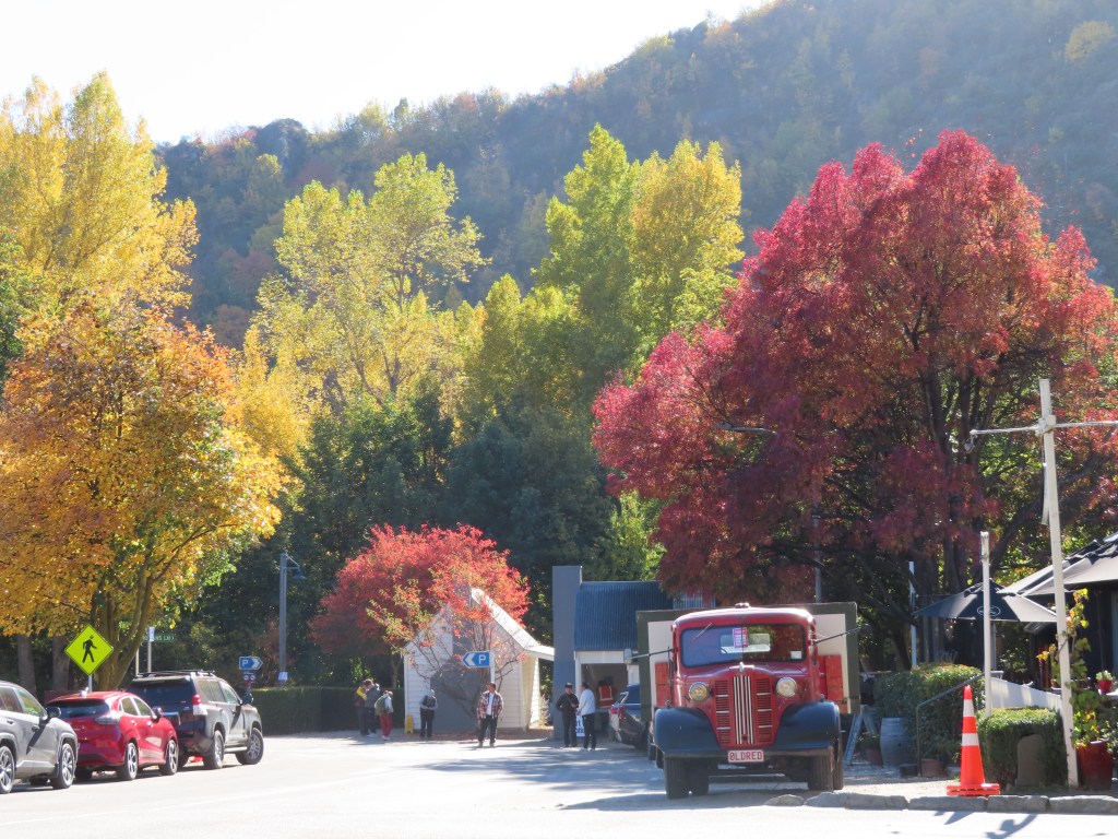
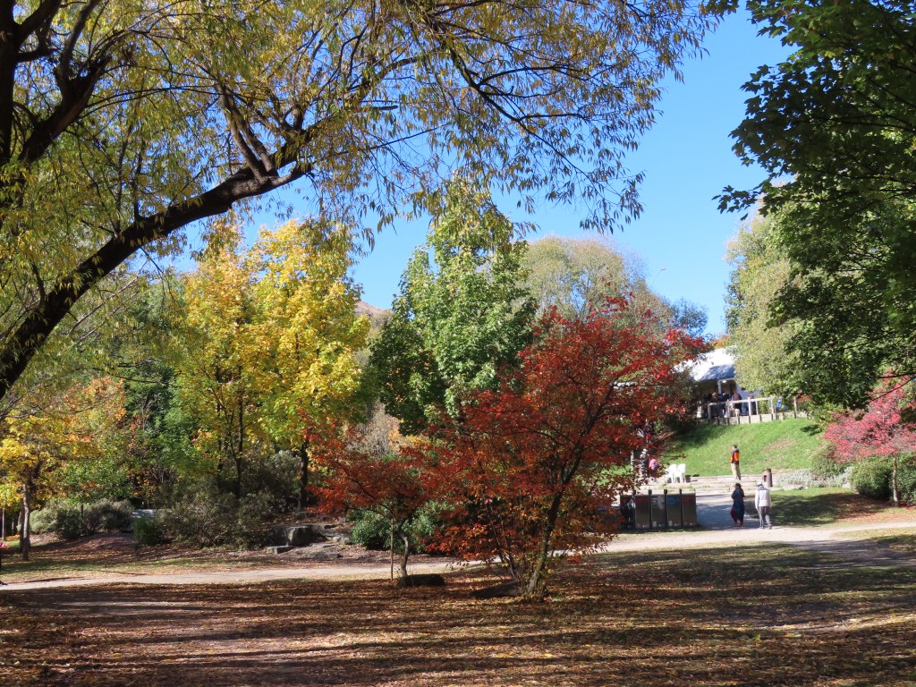
I really wanted to see the legendary autumn colours in Arrowtown, and it was so close that once we left the Driftaway Motor camp, that was the direction we headed. We knew the Arrowtown Autumn Festival was on, but we did not anticipate the sheer numbers of people that would attend. There were tourists everywhere and it took a while for us to even find a parking place big enough to fit us in. However, we did and I think it was worth it.
We did a stroll through the main street (leaving the dogs behind). There was no possibility of getting a photo of the old shops, or for the most part, being able to enter a shop, because of the crowds. We thought we might get a coffee initially, but there was no chance of that. Therefore, we carried on to the old Chinese Miner’s section.
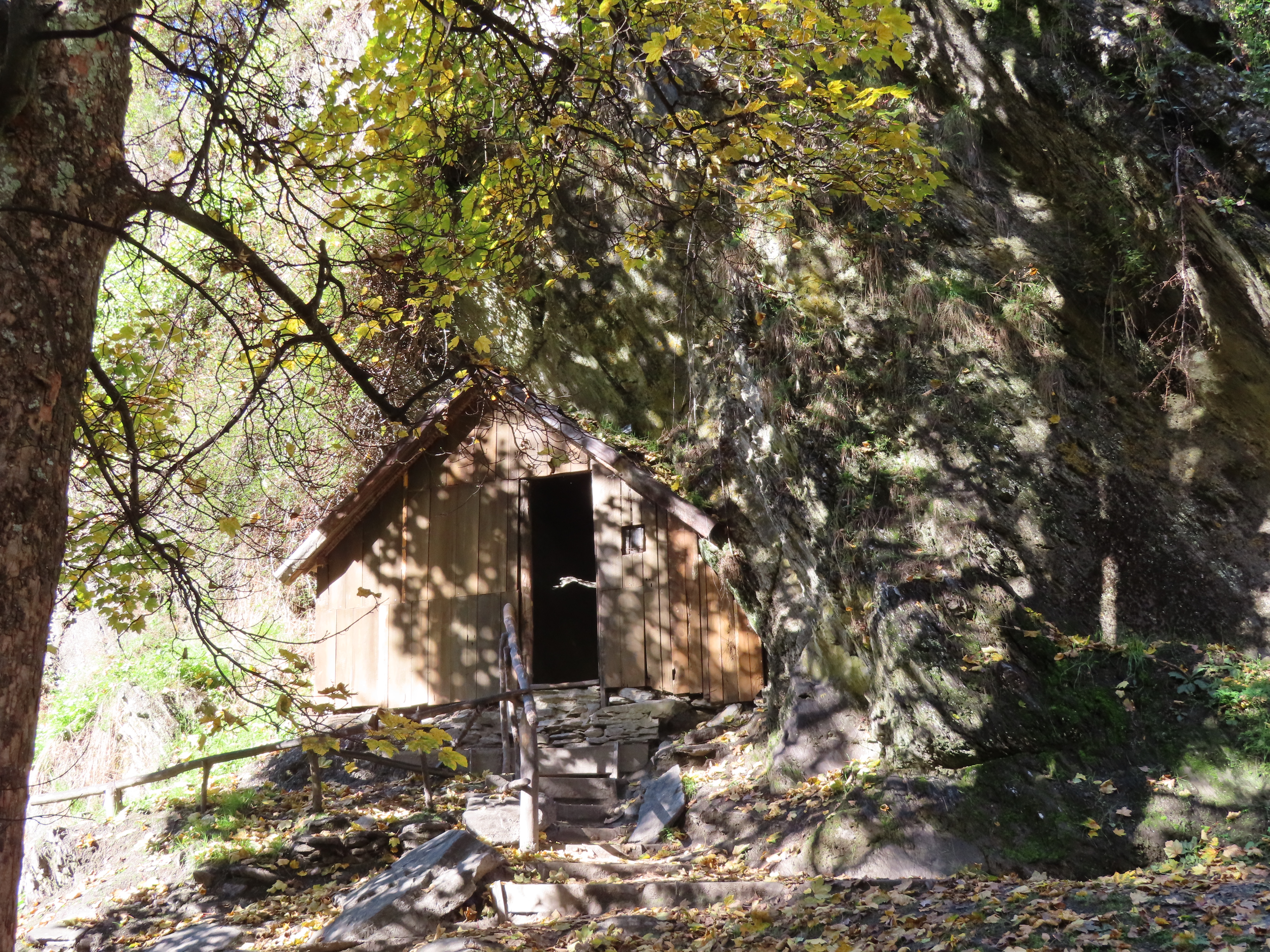
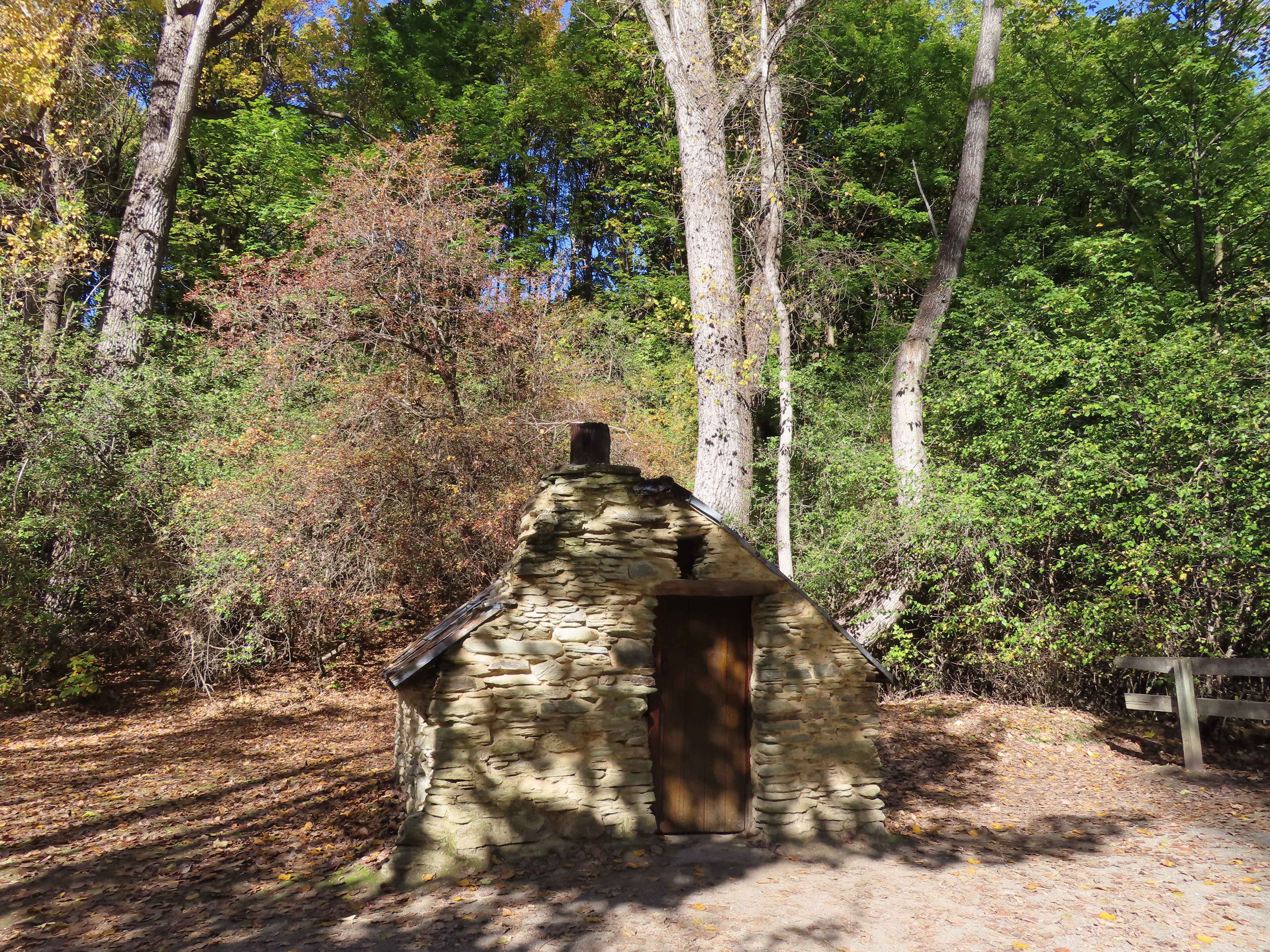
The Chinese were very badly treated by the rest of the gold mining population, and this was not helped by the fact that few of them could speak English. They were not allowed to live in towns, and had difficulty getting the materials required to build their huts. As a result they tended to have their own little villages, with their own shop, and other services eg doctors etc. They were often given the worst plots of land to mine and to live on, and they had to work twice as hard as the other miners. Some stuck it out, and were successful. Others decided to make their money by growing vegetables, by baking bread, and other farming to provide food for sale to the miners. You can certainly understand why when you see the houses that they had to live in, in the freezing cold.
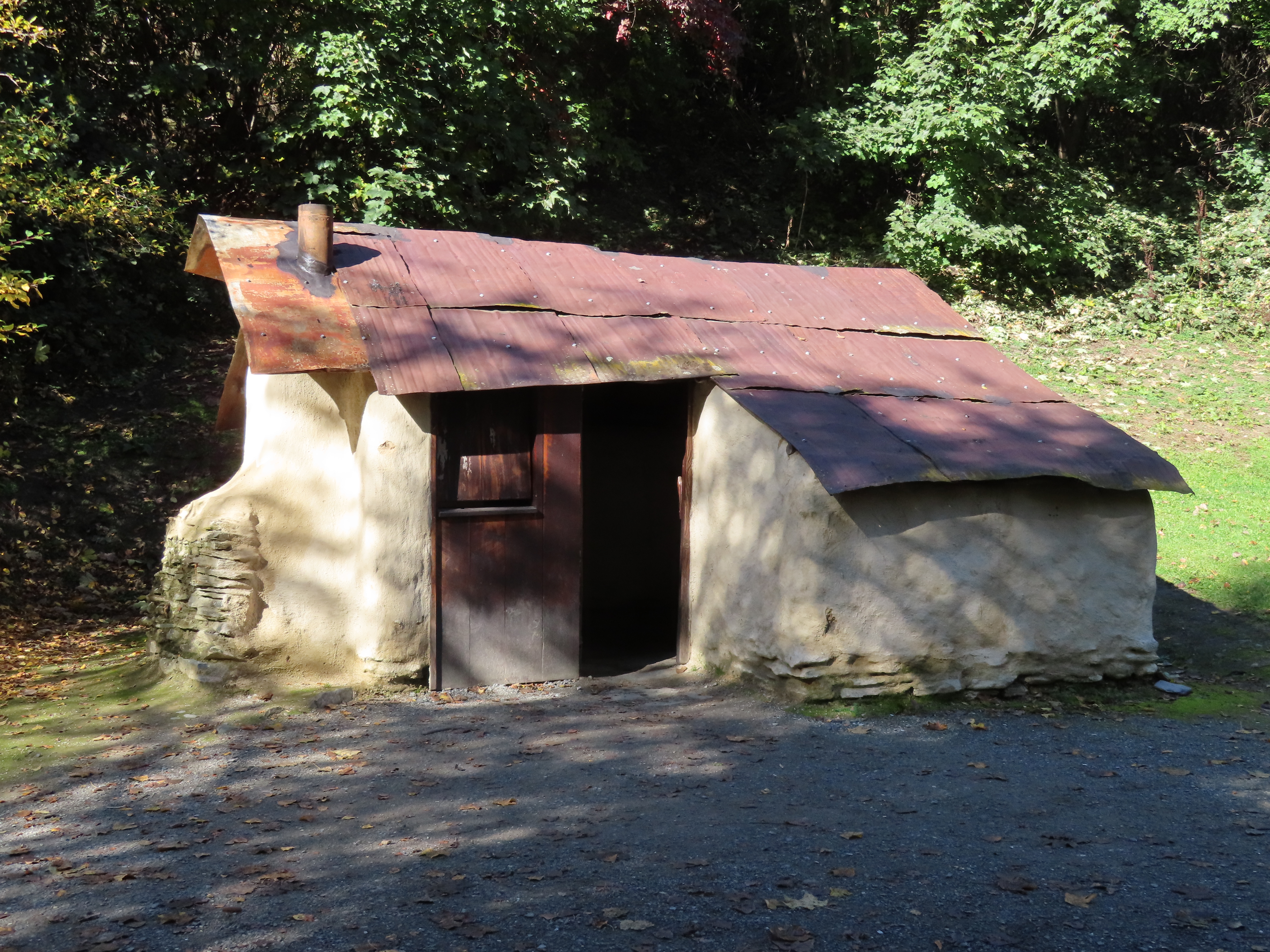
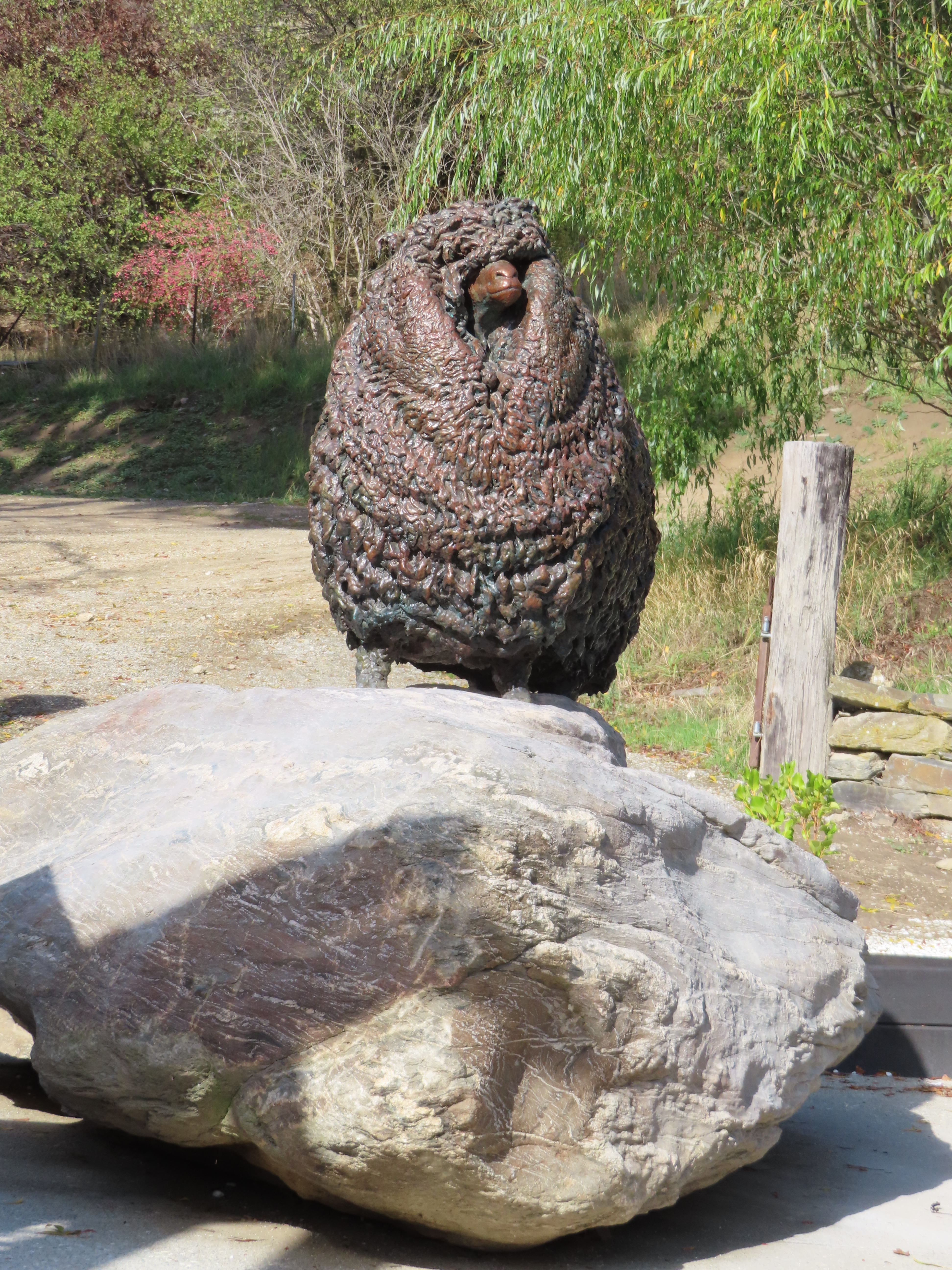
The Chinese Miner’s shop was the biggest building by far.
We had a leisurely walk by the stream to take in the views.
We finally did find a place where we could get a coffee and a scone, before we wandered back to the motorhome. On the way we passed an Asian bride and groom in the main street trying to get their wedding photos taken, but having to contend with people always getting in the way of their shot. I could feel their frustration.
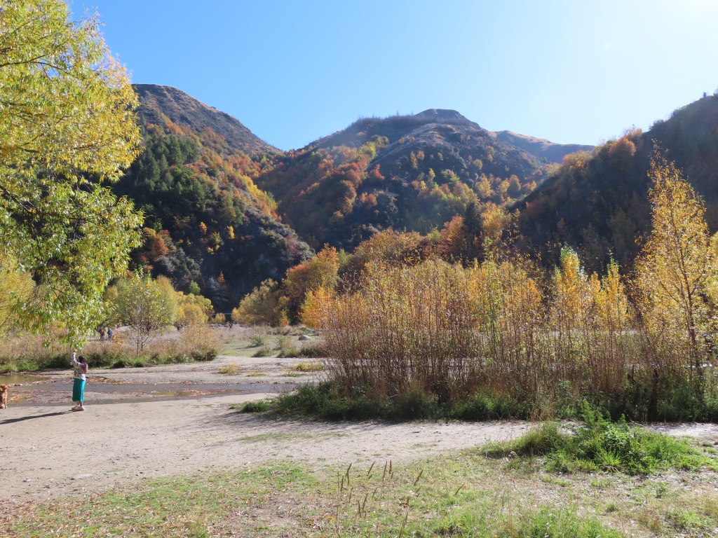
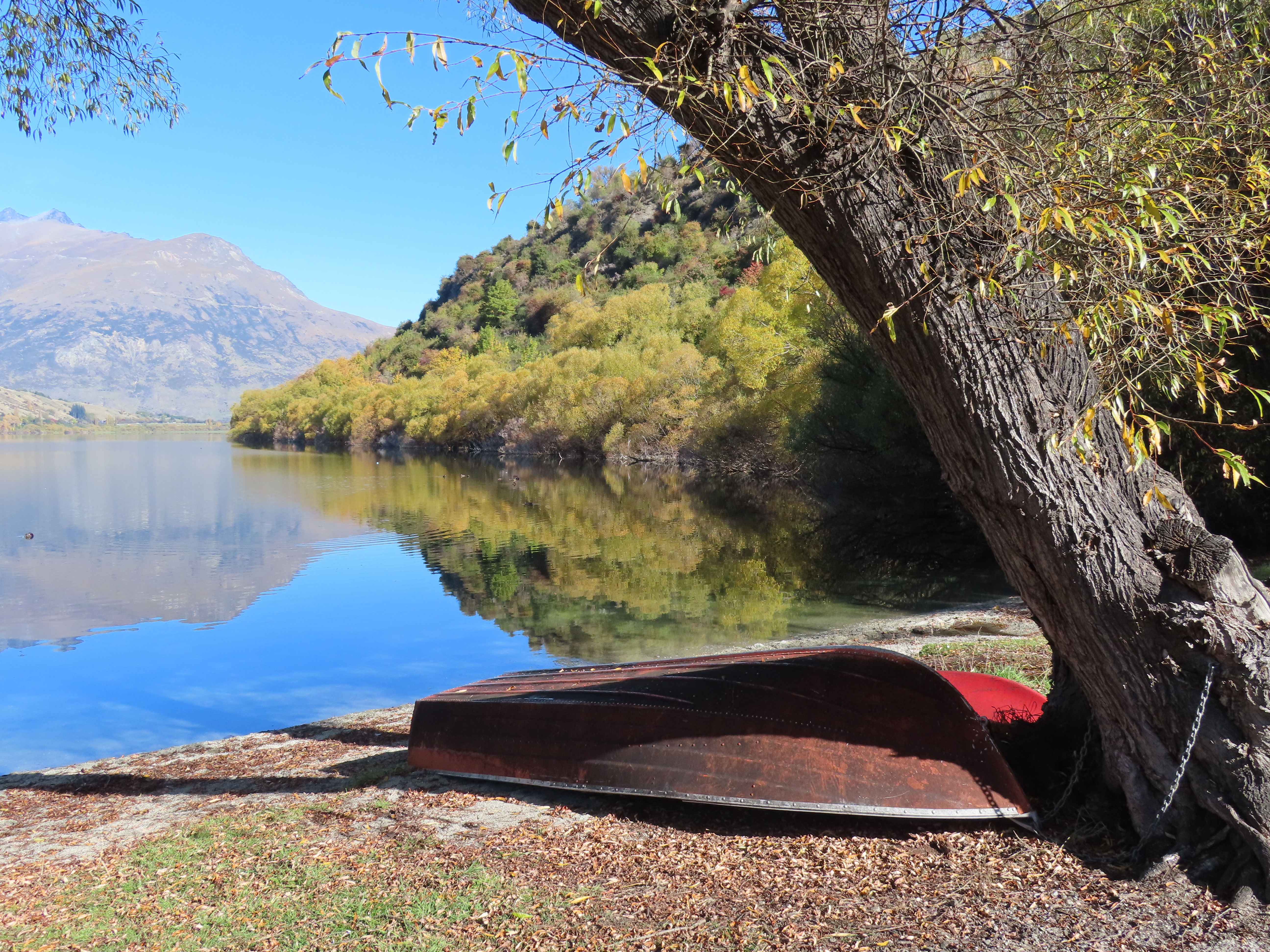
We happily left Arrowtown’s crowds and headed for nearby Lake Hayes. This was once a freedom camping area but that was stopped because of the way the land was treated. We stopped in to take the dogs for a walk.
The track was in really good condition and we were able to walk a couple of kilometres before heading back to the motorhome.
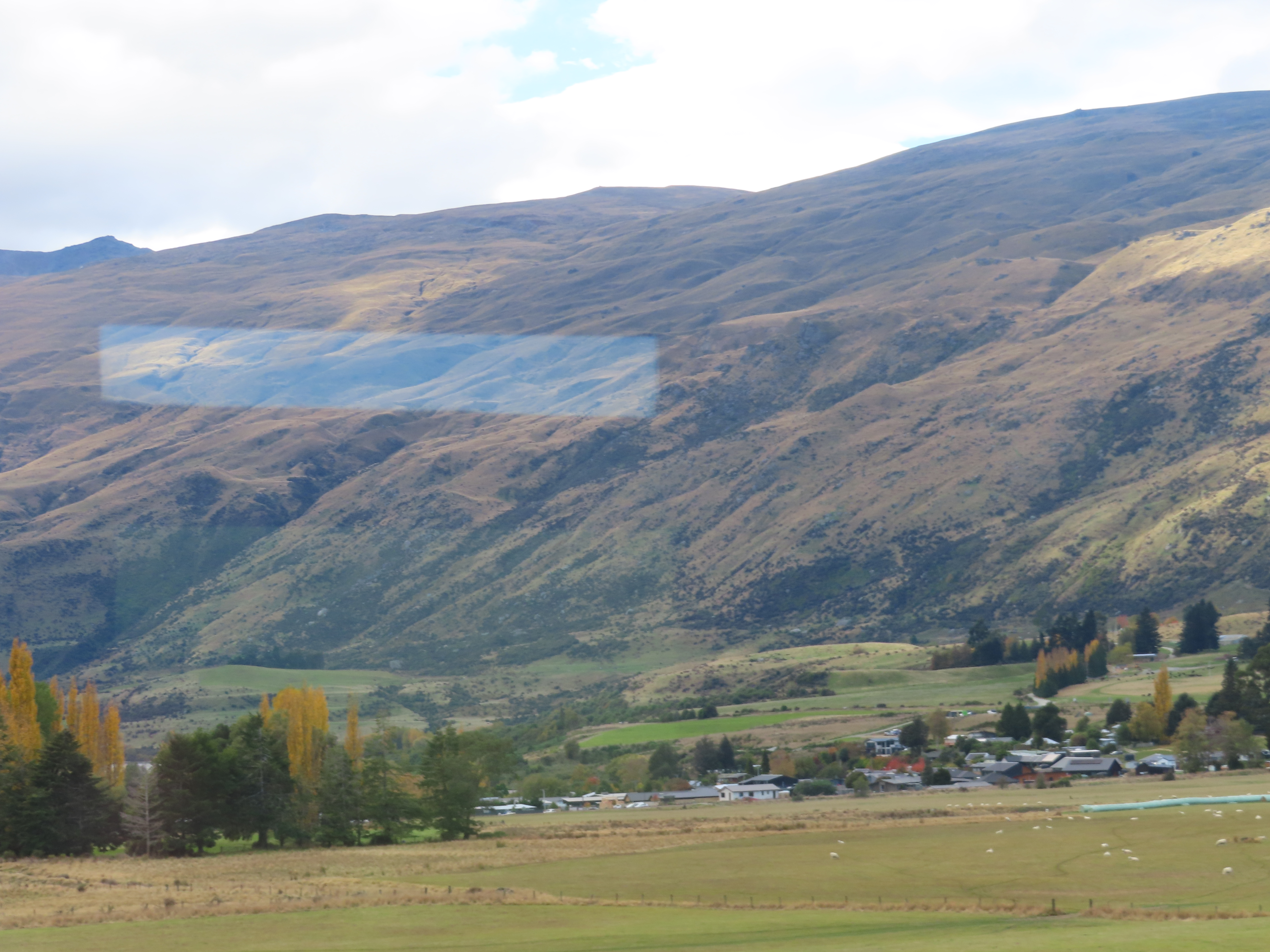
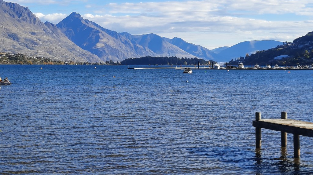
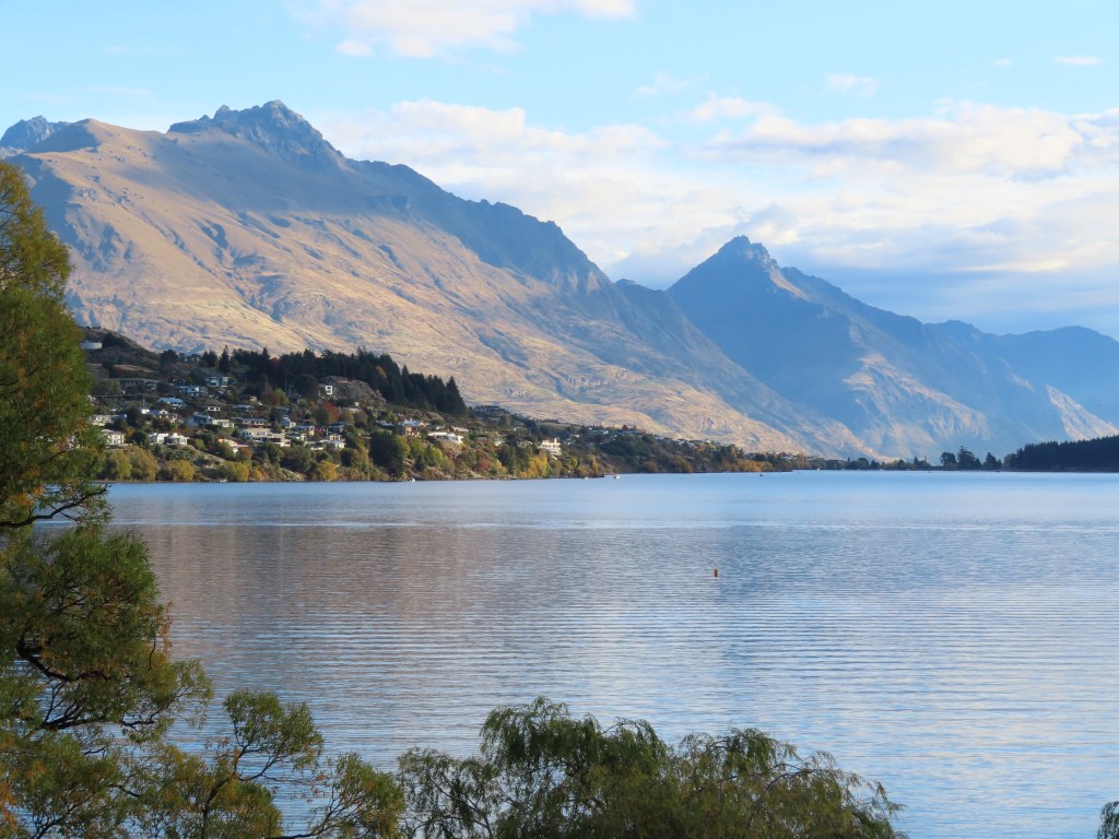
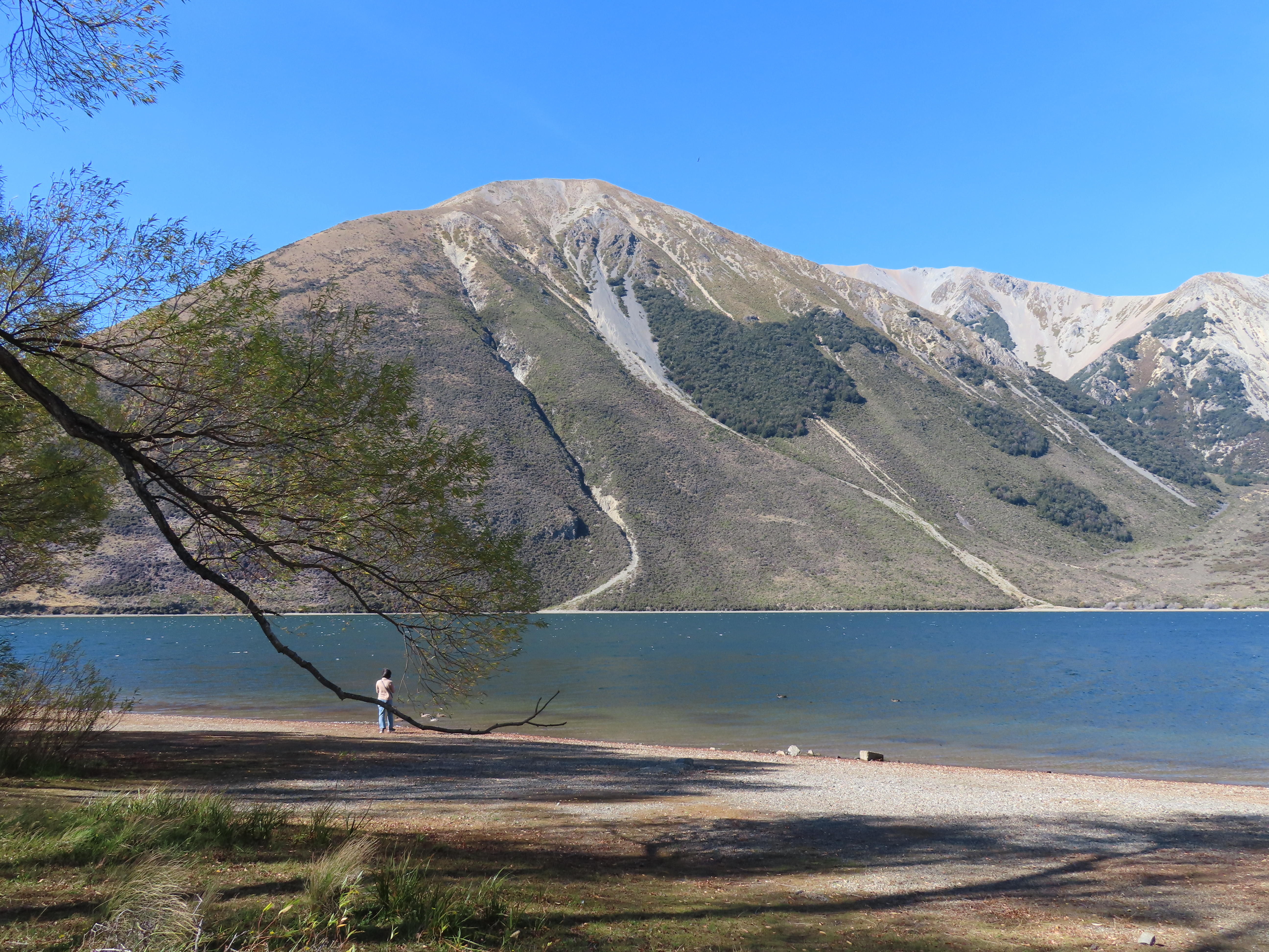
By the time we got back, we had to start thinking about where we would spend the night. We headed back towards Queenstown, bypassing the town, following the road alongside Lake Whakatipu.
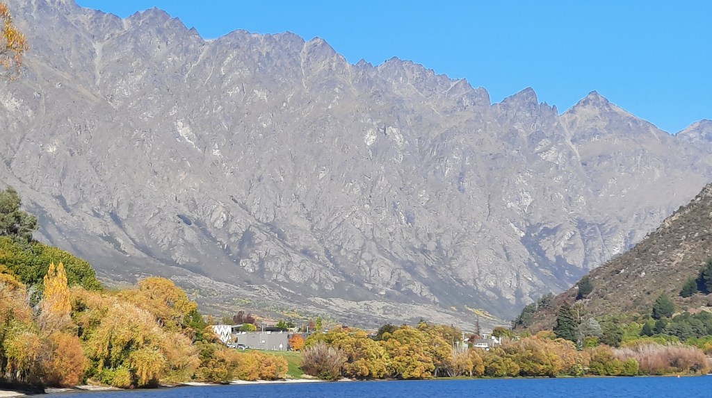
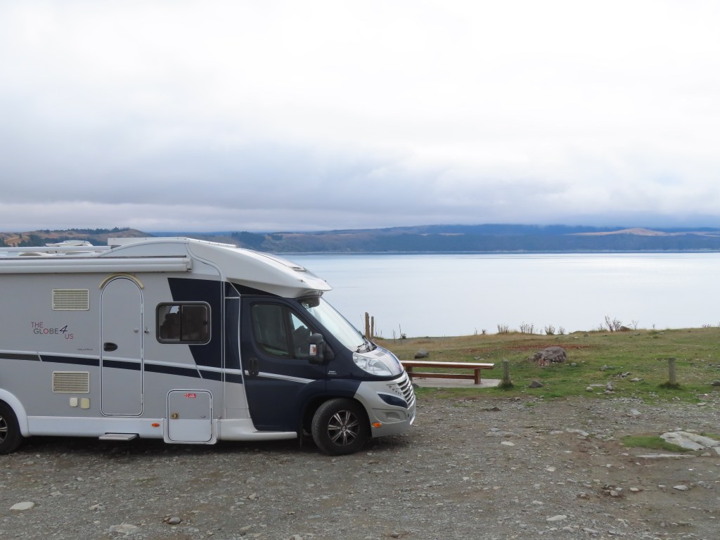
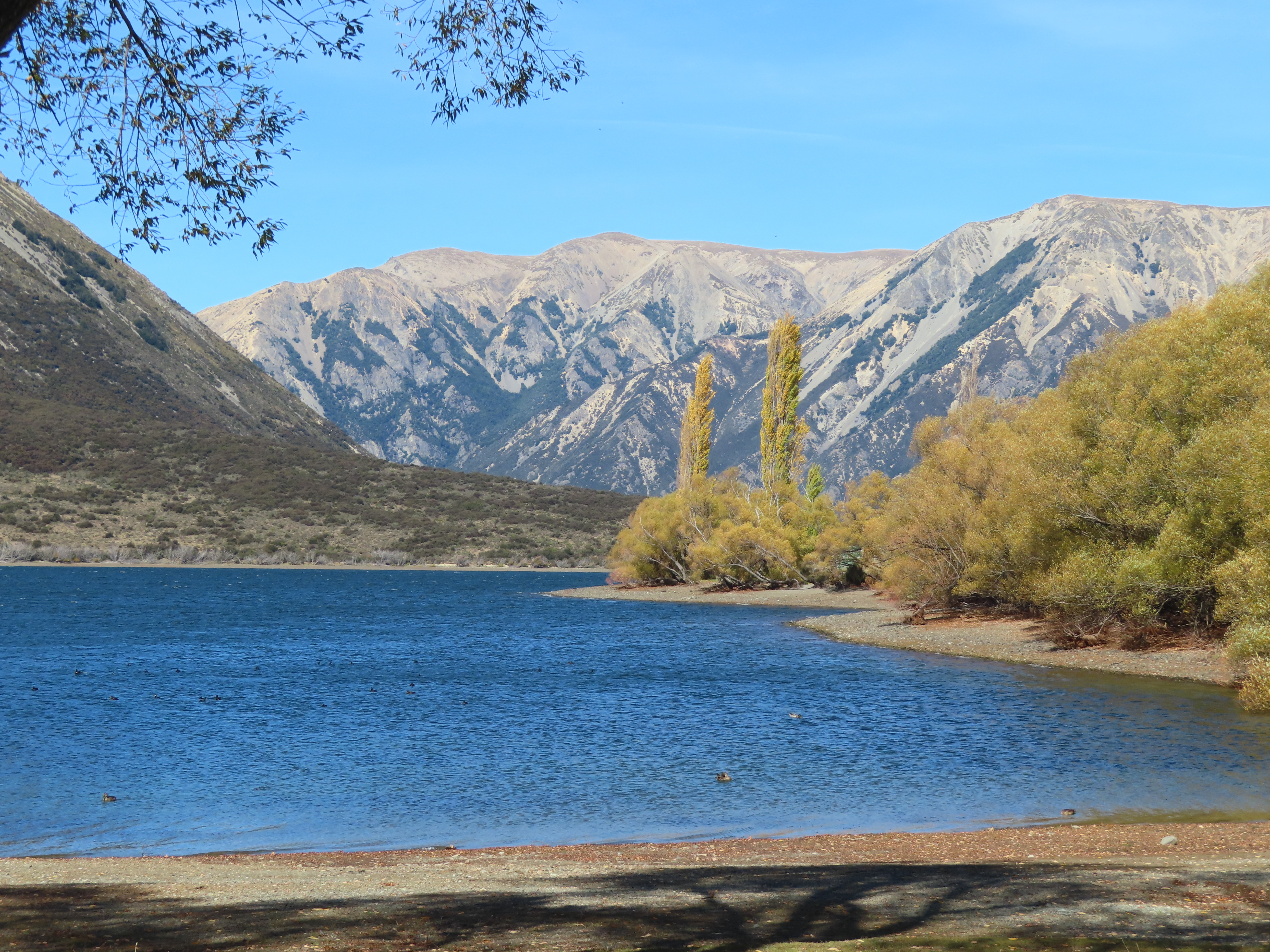
As usual, the Remarkables are remarkable. We decided to stop at a freedom camp at the side of the Lake, and managed to get a good spot by the water. It is amazing where you can stay for free in NZ.
We decided to spend 3 nights here because we had a train to catch on Sunday!
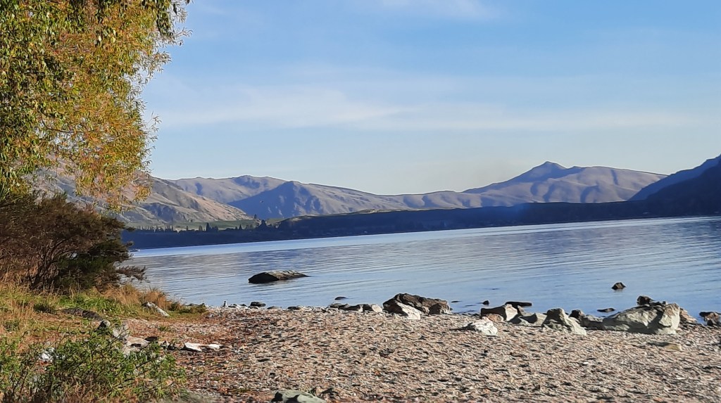
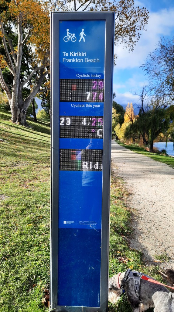
We normally avoid Queenstown as it is definitely NOT motorhome friendly, but this time we decided to stay at the Driftaway Camping Ground, in Frankton. This is a fairly new camp, and it was a delight to stay at. Here, we had the chance to catch up on laundry, and have some beautiful hot showers. It was only a short walk through the gate to the lakeside, with extensive walking/cycle tracks. We came across this automatic counter telling you how many cyclists had been this way today – nothing about walkers though.
The scenery from our campsite was beautiful as well.
The camp had amazing facilities for keeping children entertained – ping pong, bouncy mat, a little slide, sandpit etc. Everything was spotless, and the barbeque area had views to die for. The camp was pretty popular and almost full (school holidays I guess).
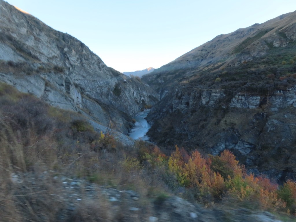
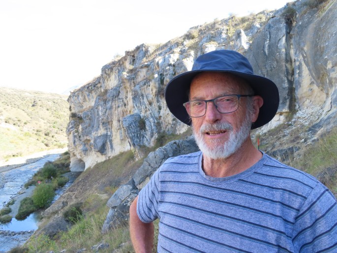
The next day we took a taxi into the centre of Queenstown (at an exorbitant price), to meet our tour party for Skipper’s Canyon. The road to Skippers is reputed to be the most dangerous road in New Zealand, and our 4wd Jeep was being driven by a slip of a 21 year old girl. However, she quickly gained our confidence and she had been driving this road as a tour guide for the last 5 years.
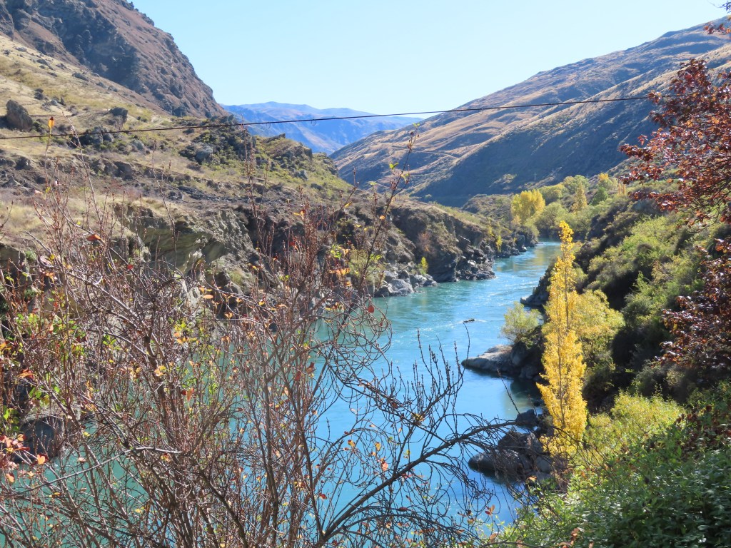
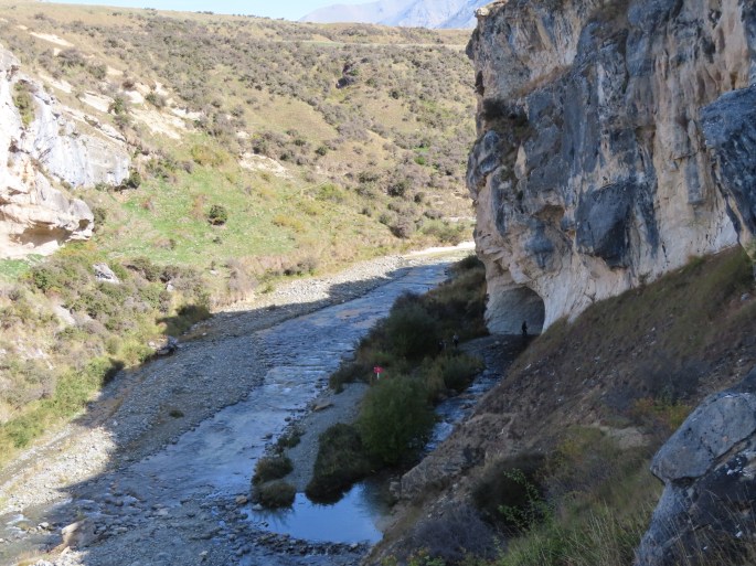
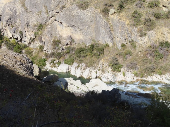
The tour follows the sides of the Shotover River. The road is a public road, but is not maintained by either Transit, or the local council, so it can be pretty rough in places. Ocassionally, one of the local tour companies will pay for a grader to come through. Although it is seen as a two lane road, there are not many places wide enough to pass if you came across a car coming the other way. This happened to us 3 times during the trip, and each time, our driver had to back up some distance to be able to let them pass.
The countryside is very steep, with almost vertical drops down to the river on one side. The hillsides are predominantly of a slate type of rock which readily falls apart – so very unstable.
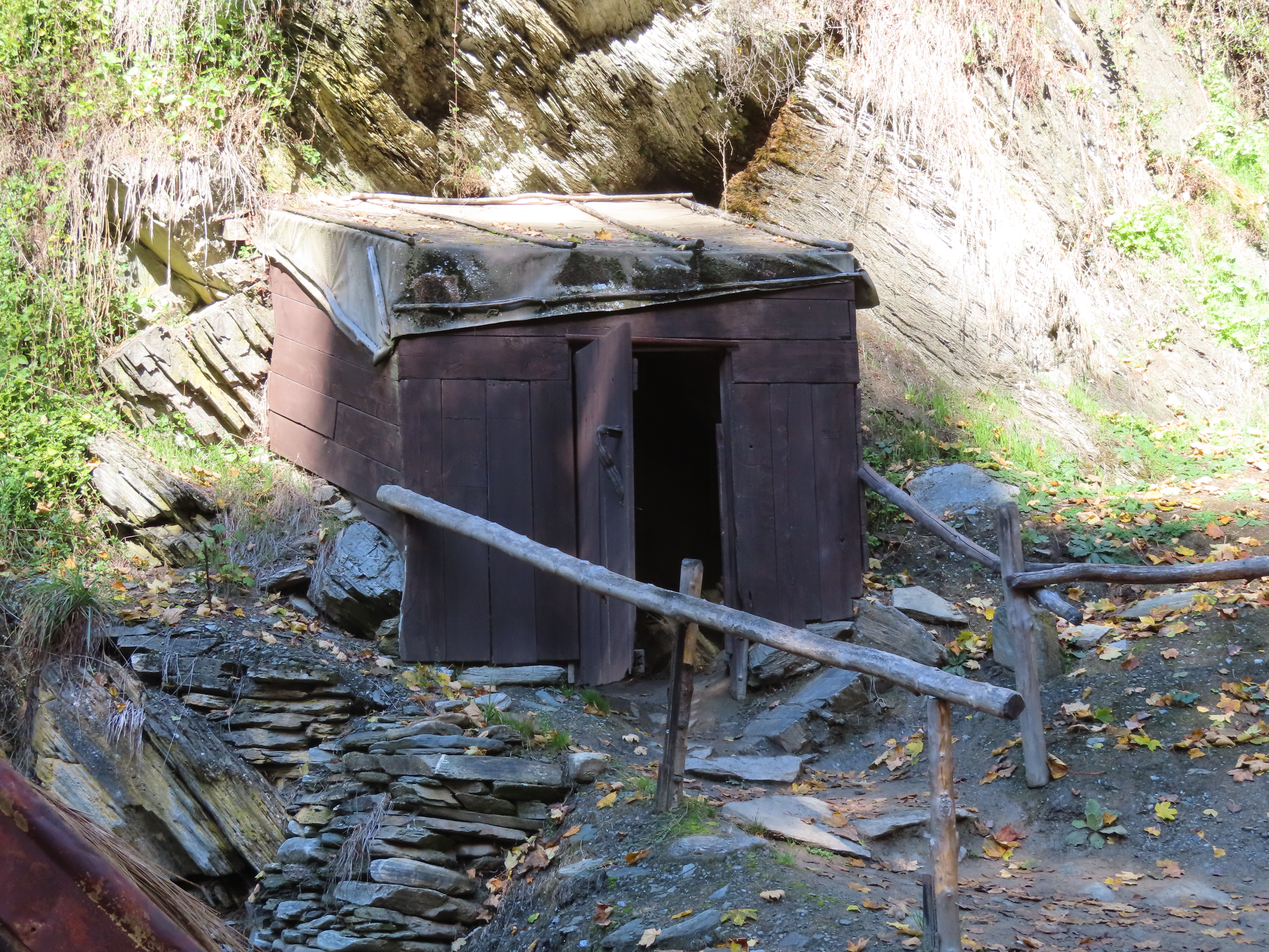
There are three permanent resident families in Skippers. One was a squatter who camped on a particular piece of land, continually for 20 years, until he, by law, then became the owner of that land. At that time he built himself a small, permanent house, and he still lives there now.
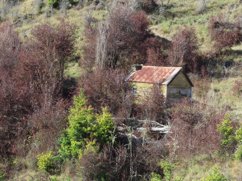
The house in the photo above was built as a meeting point, halfway into Skippers by a couple who lived further into Skippers but whose children refused to drive all that way to visit them. The halfway house was used for visits while they were alive, but is unused now.
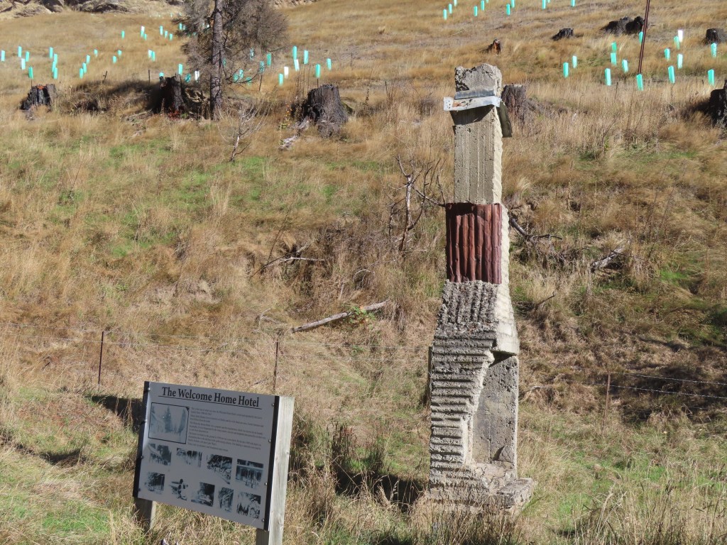
Along the road we also passed the ruins of a hotel, that used to serve the gold miners of the area. The story goes that that the couple who ran the hotel needed help, so they hired a young lady. Her employment lasted 5 days, when she was whisked away by one of the miners as his bride. This happened again and again to the ladies they hired to help, until in the end they advertised in Christchurch for the ugliest woman they could find to help them out. It was to no avail – 5 days later she ran off to be married to a miner.
The Shotover River was an important gold mining area, and that was what the road was originally built for. When panning for gold became less successful, miners resorted to water cannons to erode the hillsides to hopefully reveal more gold. As the result, the landscape was altered substantially, and remnants of their pipes etc are still visible.
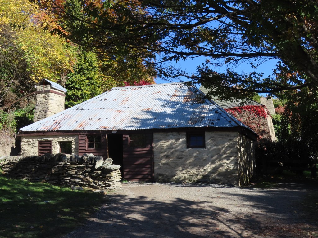
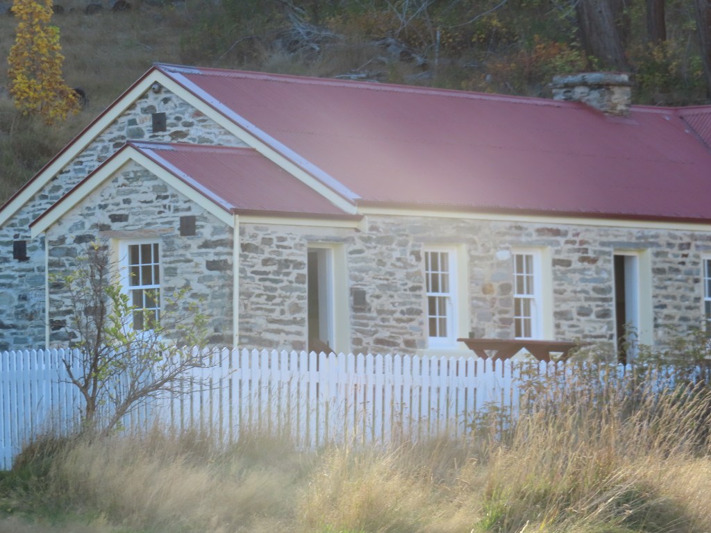
The midway part of the tour was the old Skipper’s Canyon Schoolhouse, where we stopped for a coffee and a gingernut.
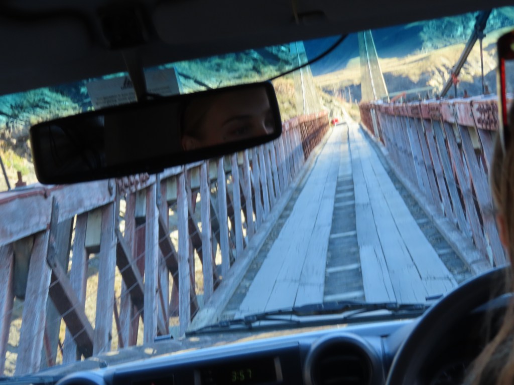
To get to it though, we had to cross the Skipper’s Canyon Bridge, which is only just wide enough for the jeep. Apparently several wing mirrors have been lost on this bridge.
All this makes you realise what a hardy bunch our ancestors were. Maybe it was worth it – Skippers was once known as the richest goldmining area in the world! We were amazed that today, there were three families camping here for a few nights. Hope they don’t freeze to death.
We made our way back, but stopped along the way to go down to the River where we had the opportunity to pan for gold. Our Guide demonstrated for us, and out of a spade full of sand from the river bed, all she got was one tiny speck of gold. The rest of us decided it wasn’t worth getting cold and wet for.
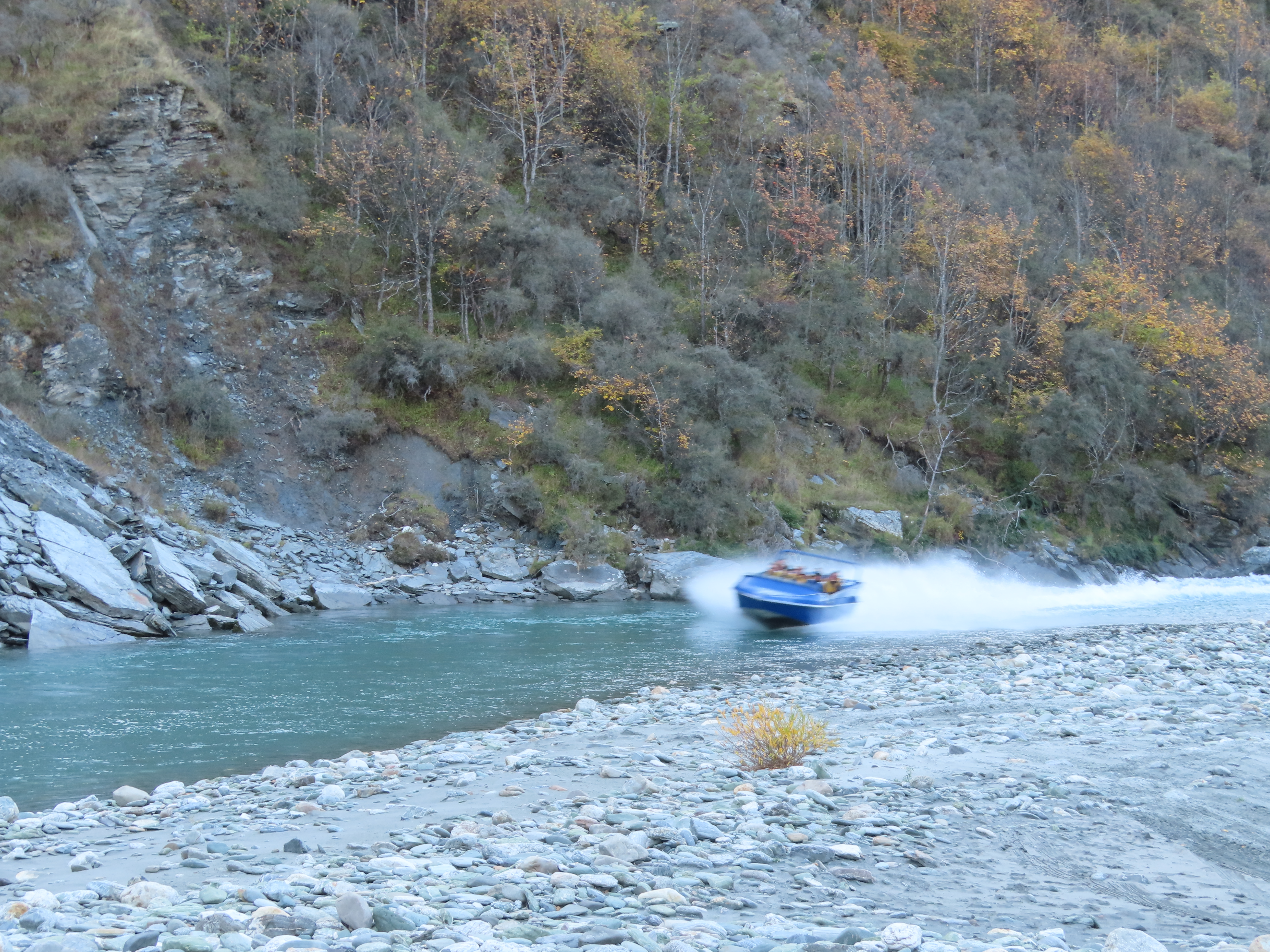
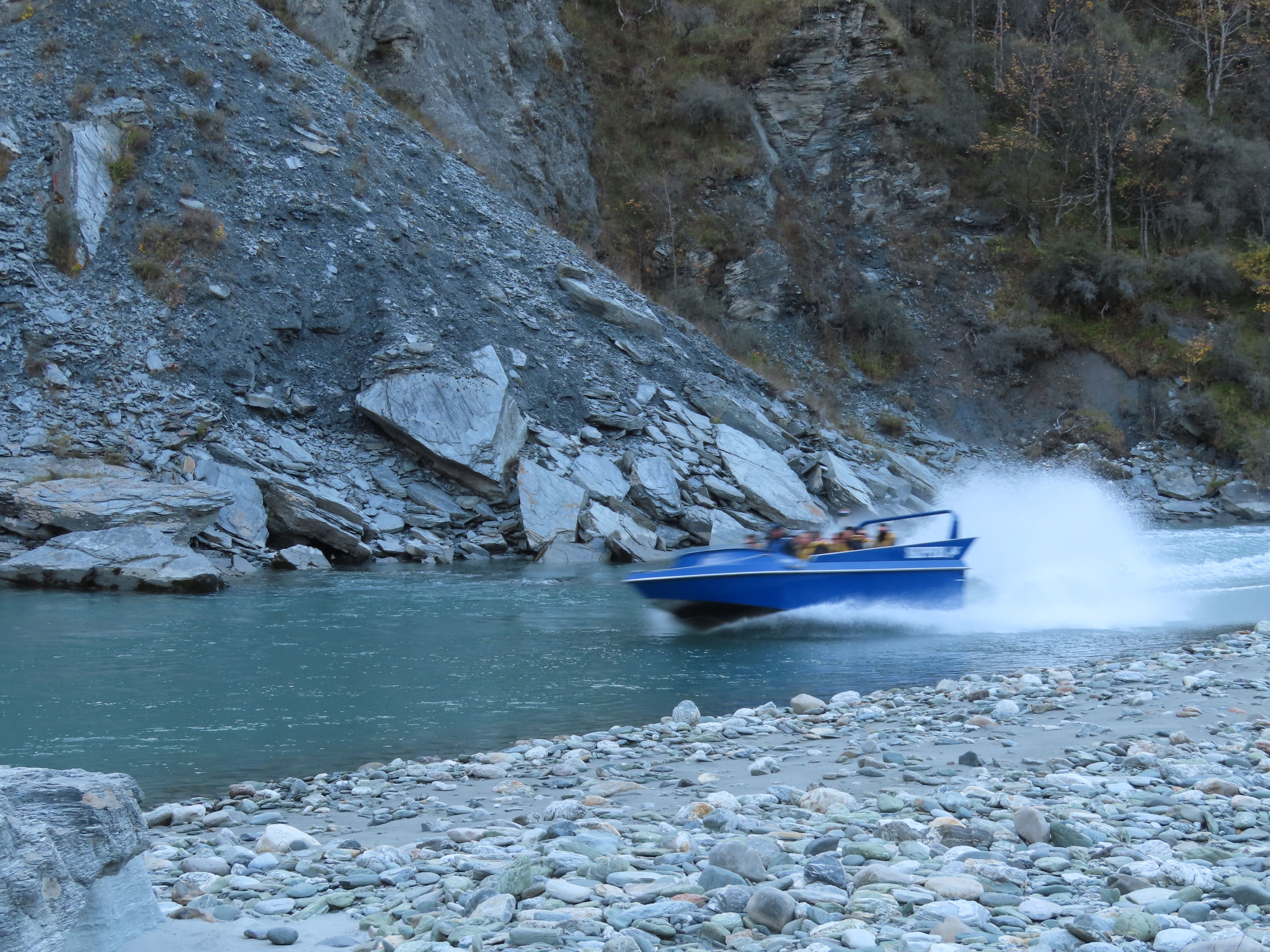
This was also the site for the Shotover Jet base. We hung around to watch it return.
Overall, it was an educational and interesting trip, but there was no way the motorhome would drive on that road! I seem to remember my Dad saying he took the bus over it but surely I misunderstood. I don’t see how a bus could get around those corners. Apparently, stock trucks don’t use it – all livestock has to be walked in or out.
Once back to Queenstown, Bruce and I were shaking our heads at the queue for Ferg’s Burgs. It was about 50m down the street when we left, and was still about the same when we came back! They must be really good burgers!
We will be sorry to leave tomorrow. The scenery has been wonderful, but I really want to see if I can visit Arrowtown in the autumn.
After a peaceful night at the side of Lake Pukaki, we continued southwards. OOOPS – Bruce accidentally sounded the horn as we pulled out of our parking space. Hope it didn’t wake our close neighbours up!
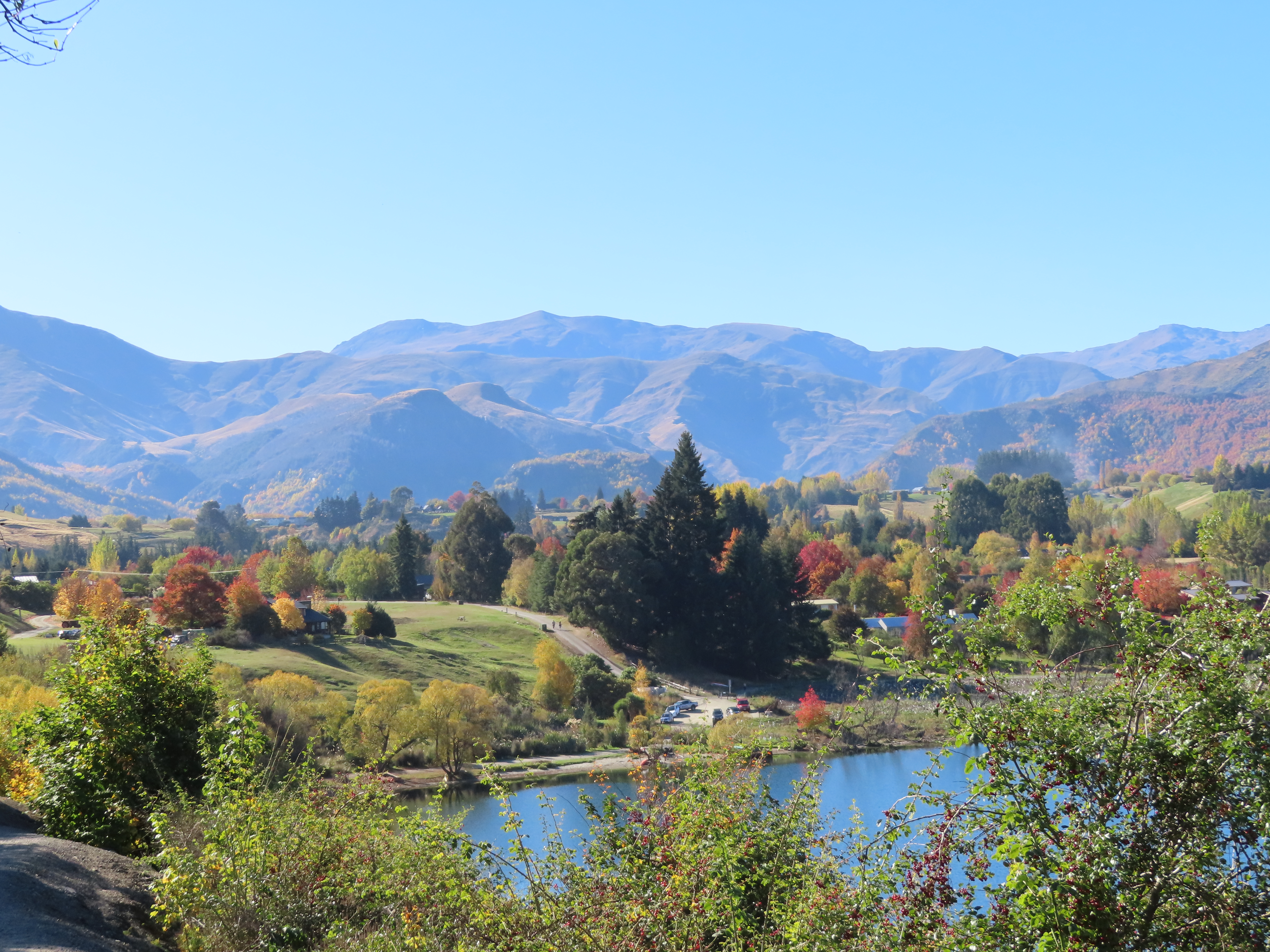
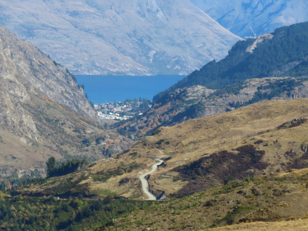
Normally we would stop for a soak at Omarama, but this time we decided to keep driving. I really wanted to go back to Wanaka, to approach a few galleries to see if they would show some of my paintings. The idea was that we would spend a couple of nights in Wanaka but found that as it was still a holiday weekend, the camps disallowed dogs. Therefore, it became a day trip to do a shop, and to visit a couple of galleries.
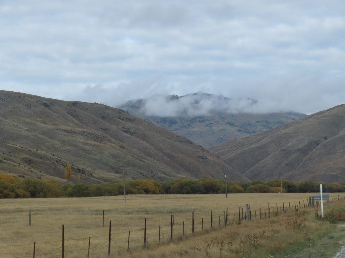
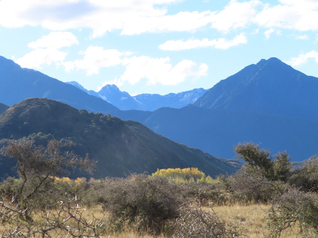
To get to Wanaka, we had to travel Lindis Pass. This is usually a very scenic trip, but as usual, the skies were overcast, and we could not get the full effect of the beautiful scenery.
In the middle of the Pass is a historic town called Tarras, and we stopped there for another look.
Bruce has decided that this trip is to be the quest to find the perfect cheese scone. The one he had at Otira remained at the top of the the table, but he had to try one from Tarras. Although it was good, it was not good enough to topple the Otira Hotel off it’s spot.
As usual, the Lake Wanaka was beautiful, but there were people everywhere, and we were lucky to get a suitable park at all. The traffic coming towards us from Wanaka was a continuous stream, as the festival Wheels over Wanaka had just finished. We saw all sorts of big machinery coming away from the town – talk about carbon burning.
The galleries I visited had beautiful paintings and they both expressed an interest in my work. I need to develop and proper portfolio that I can email them. The gallery I visited in Geraldine was also keen on my work, but they take 50% of the sale. I am not sure about Wanaka.
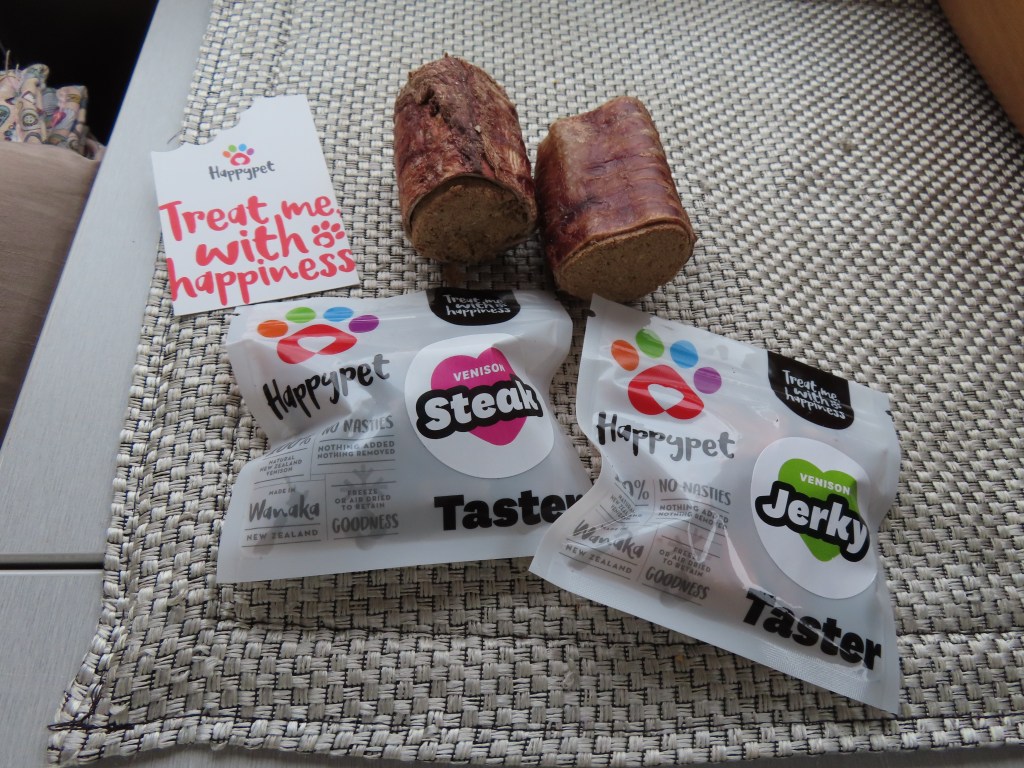
Once I had finished my visits we carried on to Luggate, a town not far from Wanaka where we stayed at a Park Over Property owned by Motorhome association members. This was a bonus for the dogs as well, because the lady of the house worked at a petfood factory down the road, and they manufactured dog treats from venison, and we were given samples.
The tube things at the back of the photo are the trachea of deer, stuffed with dried marrow etc. I had temporarily placed them in the fruit bowl, but Hunter thought they smelt really, really good, so he managed to steal one. Luckily, I discovered it before he had scoffed the lot.
After our night at Luggate we are heading towards Queenstown – or rather Frankton, on the other side of Queenstown, where we are booked at the Driftaway Holiday Camp – our first camp stay since we left home.
We left Twizel, but did not actually get very far that day. Just outside of Tekapo is a NZ Army Base – what a bleak area that would be in the depths of winter. Waiouru in the North Island would be no different, so maybe the army uses places like this to weed out the weak.
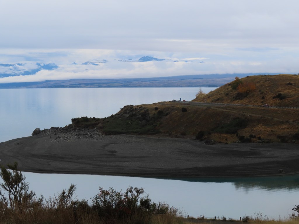
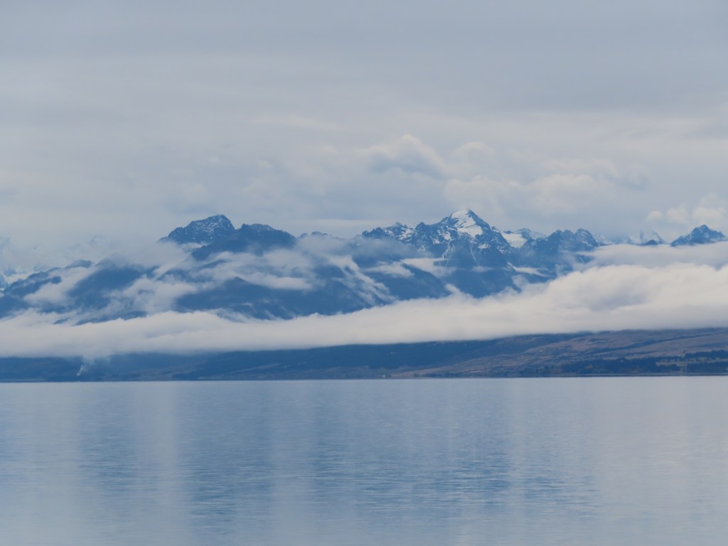
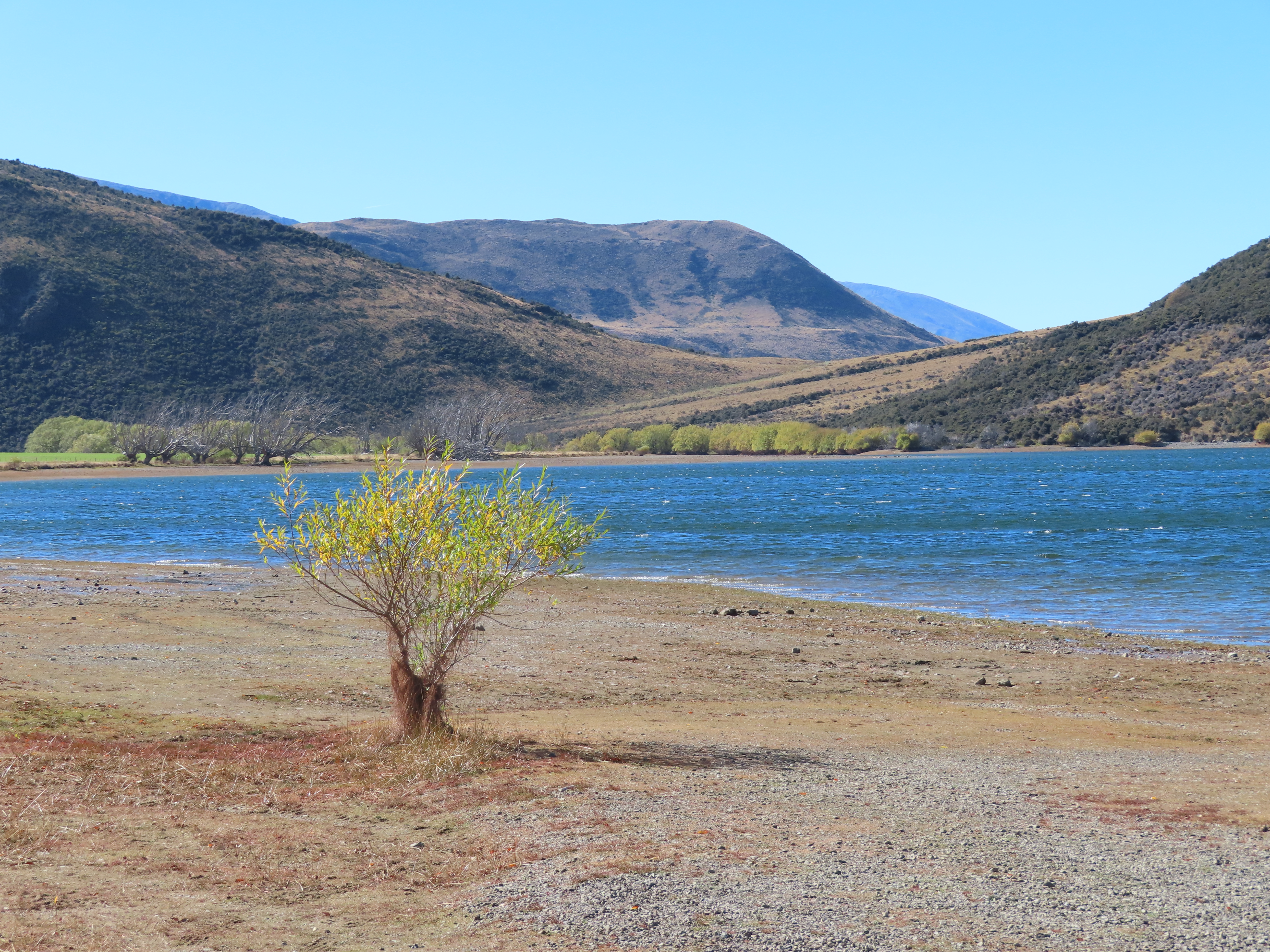
The road out of Tekapo goes through steep hilly areas, with Mount Mary out to the right and the Tekapo River to the left. It is no more that 30km down the road that the hillsides clear and the road travels alongside Lake Pukaki, which is a big fresh water lake at the base of Mount Cook. Again it was a cloudy day, so Mount Cook might not have been there for all we knew.
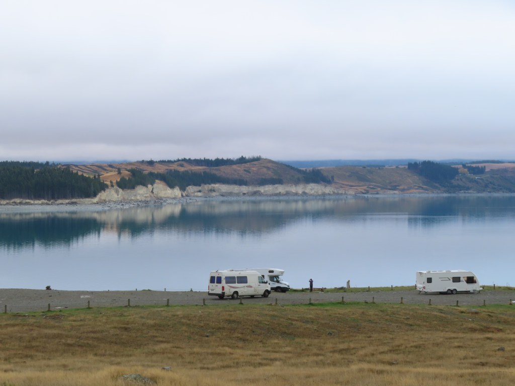
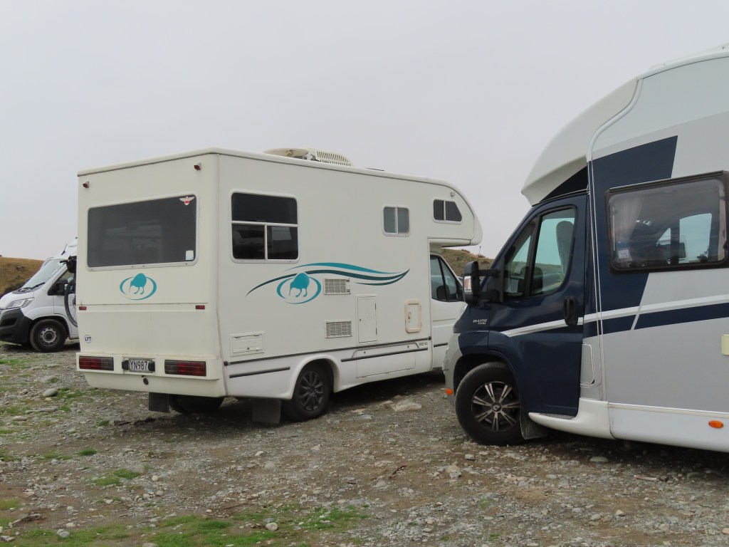
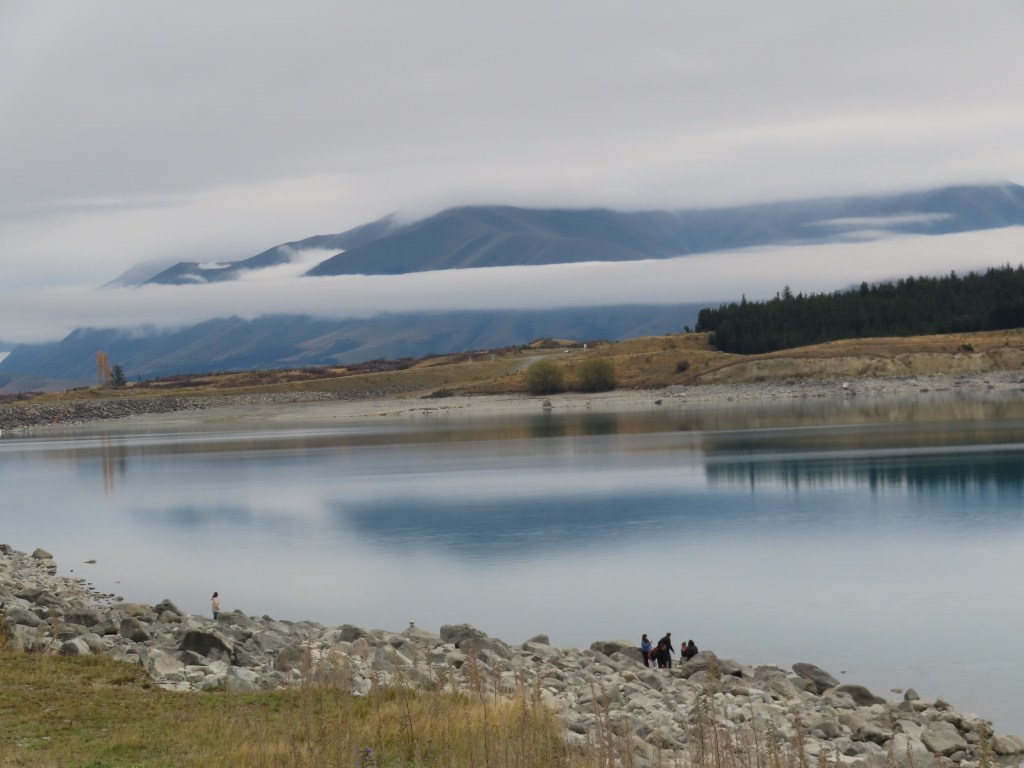
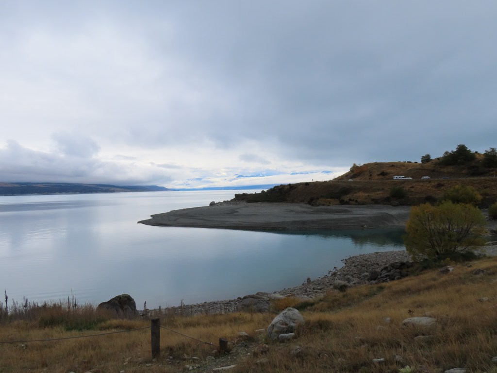
We had to stop at the first lookout we came to, and took a few photos, but the second lookout appeared to be a freedom camping site, so we decided we would stop there for a night. We were only the fourth van there but finding a level parking spot was a bit of a problem. In the end we parked at the end closest to the road going further down to the lakeside, and parked parallel to the fence.
The Parking area also ran alongside a cycle / walking track which seemed to be quite popular – lots of people out enjoying the holiday weekend.
We took a few walks with the dogs along this track and wandered down to a beach we could see further on. It was all gravel, so not easy walking, but even so, it was nice.
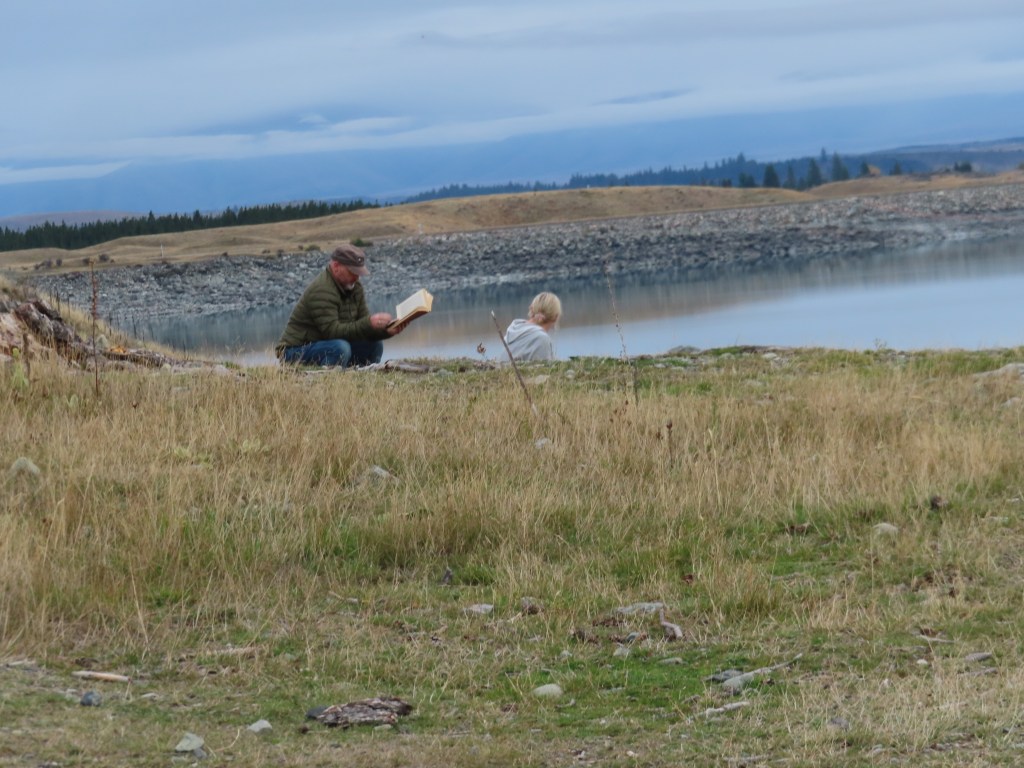
The only negative about the park occurred when an NZMCA member decided to park no more than a metre in front of our front bumper and less than a metre from a van parked on the otherside. When he pulled up Bruce asked him if he was seriously going to park there, to which he responded that he was. Most NZMCA members know they should leave a space of about 3 metres between vehicles for safety reasons, but I guess he felt that as this was a freedom camp, those guidelines did not apply.
Then to cap things off, he and his wife sat on a rock out the front reading a book – not even enjoying the spectacular view.
Nevertheless it was a great spot for the night. By the time it was lights out, there would have been about 20 vans parked up.
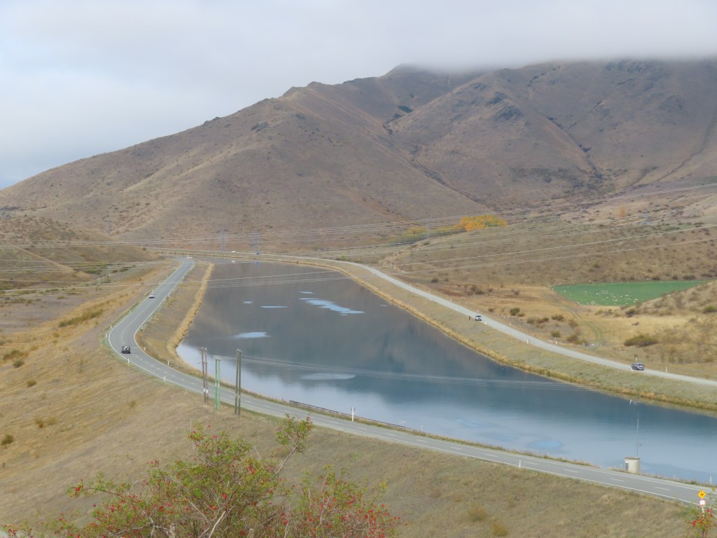
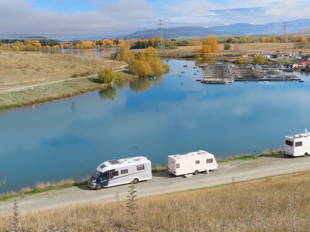
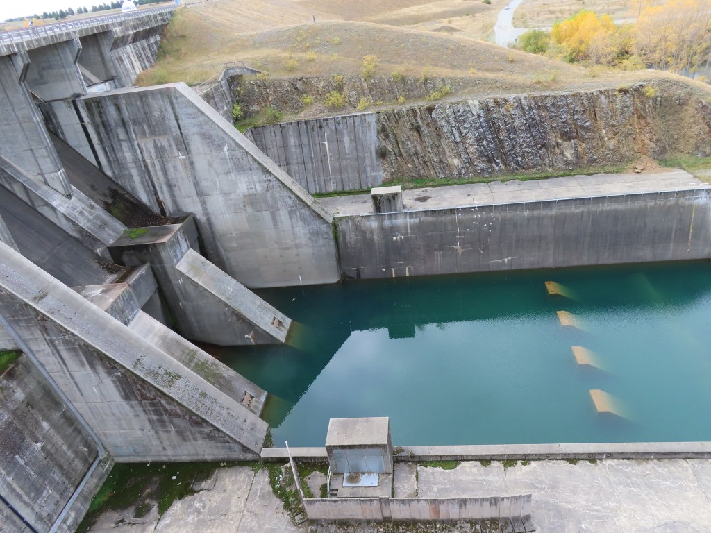
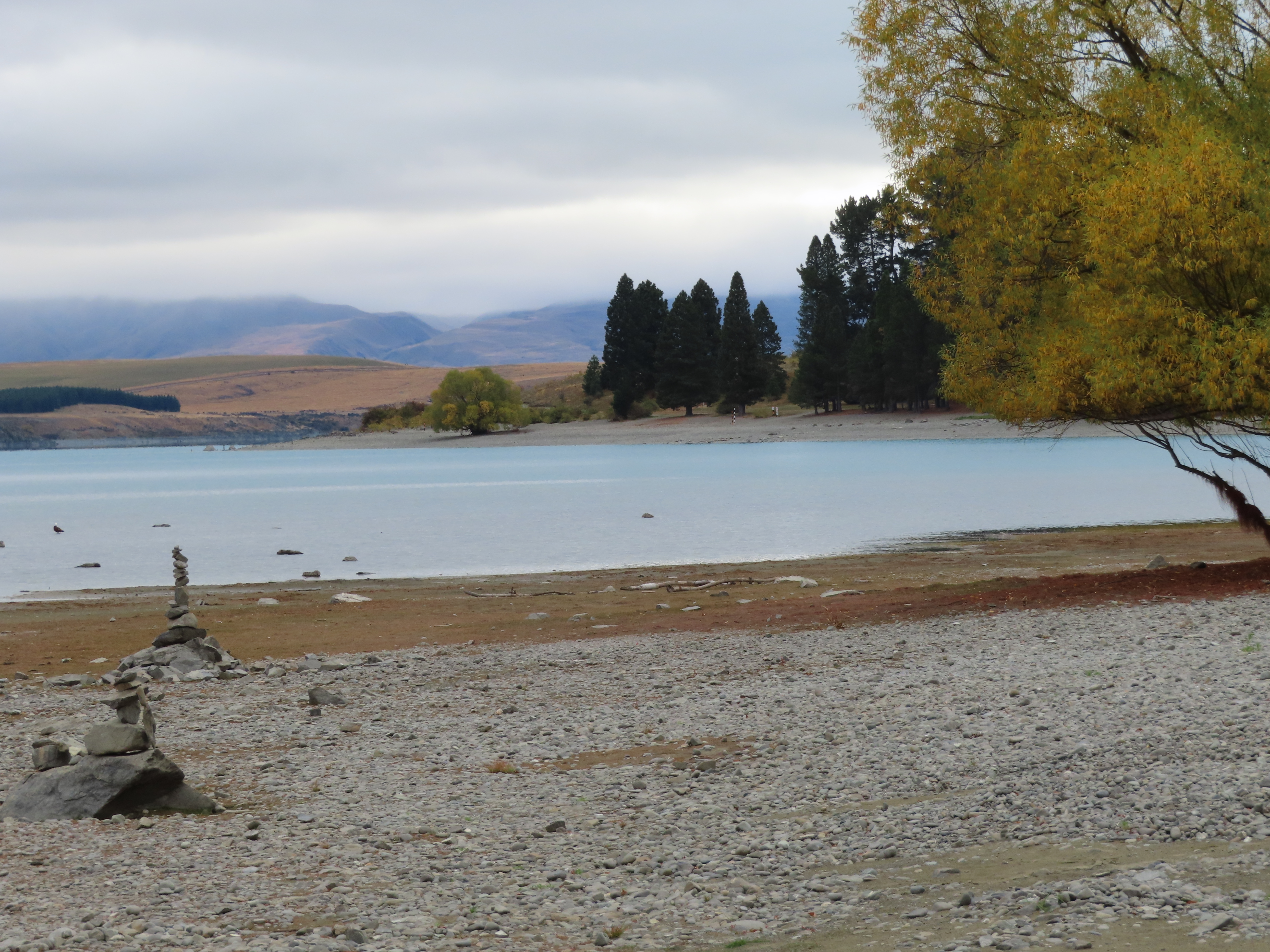
From Tekapo we headed away towards Twizel which is another favourite place of ours. The weather remained overcast with the occasional shower, so the photos I took all looked a bit gloomy. Because of the weather we decided not to stop at Burke’s Pass. We wanted to get to Twizel in plenty of time to go to the laundromat and get the washing done, and still get to the canal in time to get a good parking place.
We managed to achieve that. It was disappointing to see that the machines at the laundromat have not been updated in years, so we still had washing strung up in the motorhome to get properly dry.
However, it all got dry in the end and we had a prime parking spot on the side of the canal.
Instead of buying a fishing license, this time, we elected to watch and see if any fish were being caught before we wasted the money. There were up to 12 fisher people at any one time, but we did not see any fish being caught. We did see several fish jumping from time to time.
We did get some salmon though – we purchased it from the salmon farm shop!
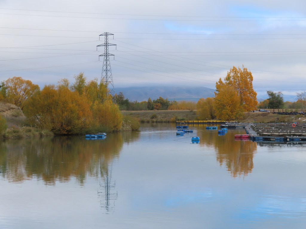
Up behind the canal is a steep little hill, that we walked up with the dogs. At the top is a lone apple tree – heavily laden with red apples with no Codlin Moth damage. We picked some, and filled my pockets, and stewed them up to have with our breakfast. The view from up there is pretty special.
The next day we walked under the bridge at one end of the park and headed out towards where the canal starts from Lake Ruataniwha. There were several fisher people there as well – people out and about, taking advantage of the Easter break. We didn’t see any fish being caught there either!
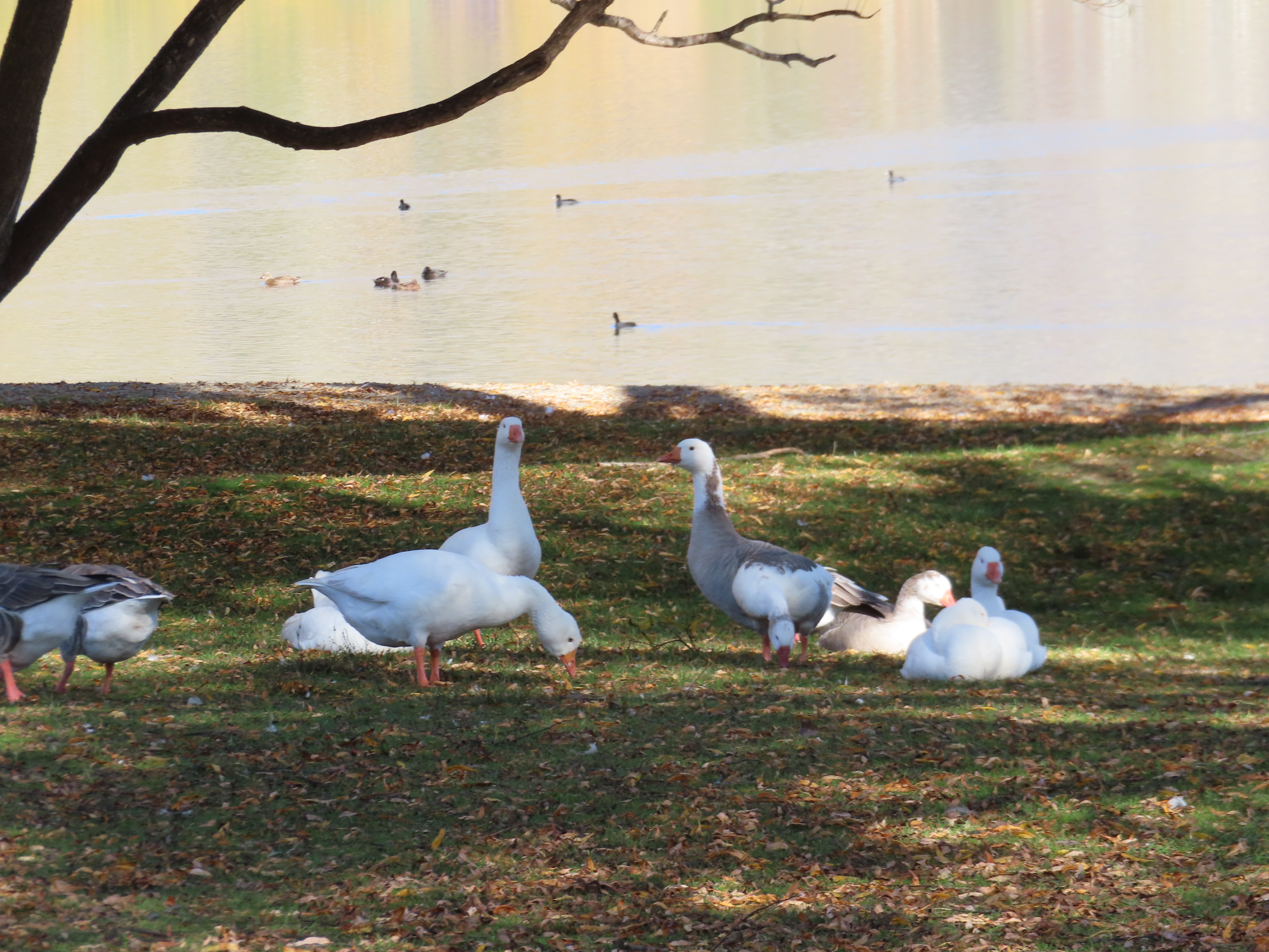
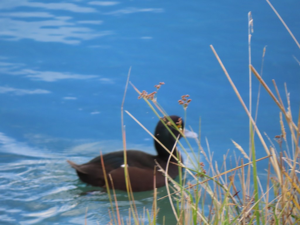
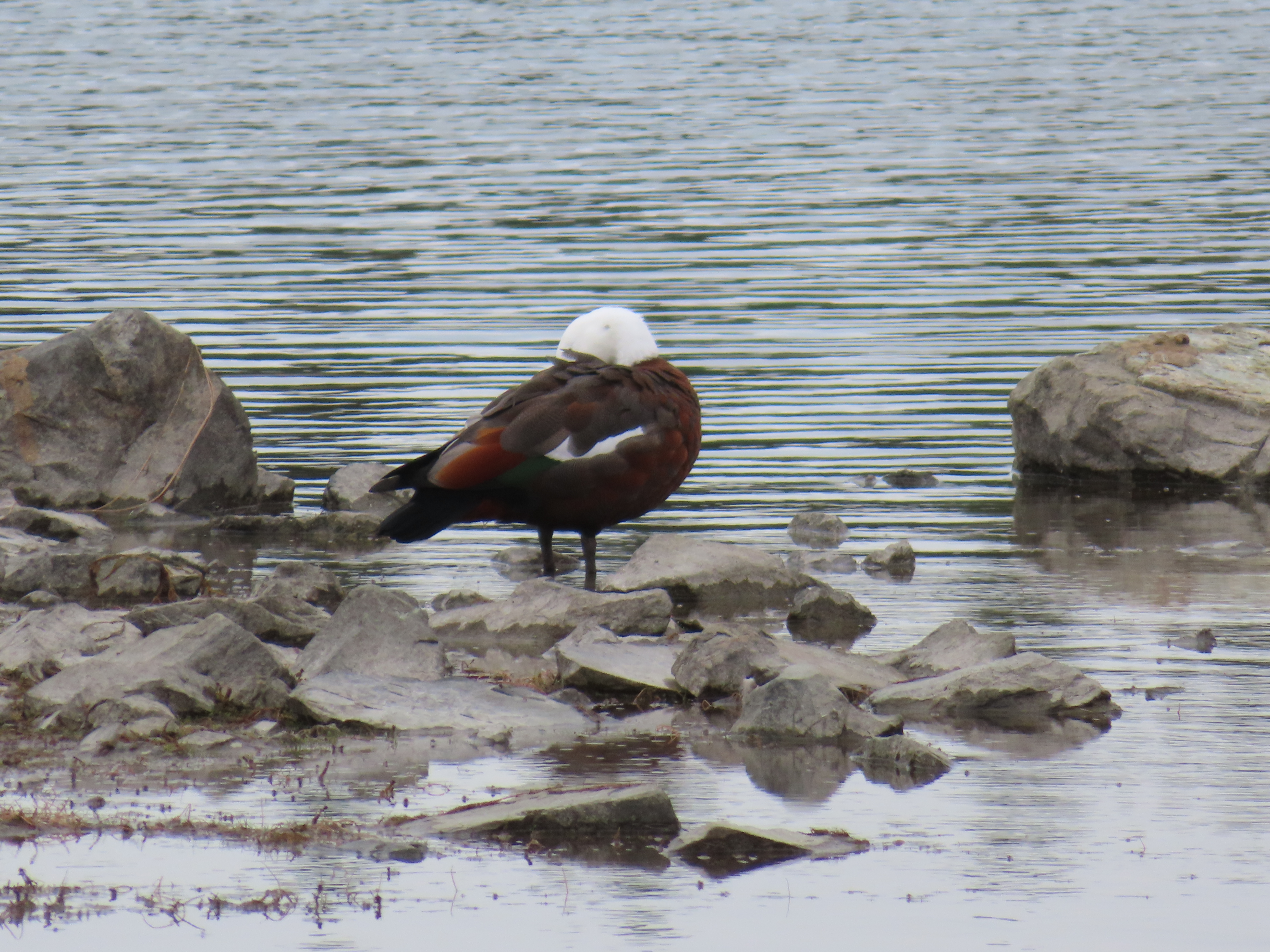
We really enjoyed sitting outside the motorhome watching the birds. There were many little black ducks, called the NZ Scaup or Papango. They are New Zealand’s only native diving duck and seem to have a little fluorescent strip at the end of their beak. Really cute!
They swim around in groups of 8 – 10 , and then all but 2 will dive pretty much at the same time. The remaining two seem to stay as look outs.
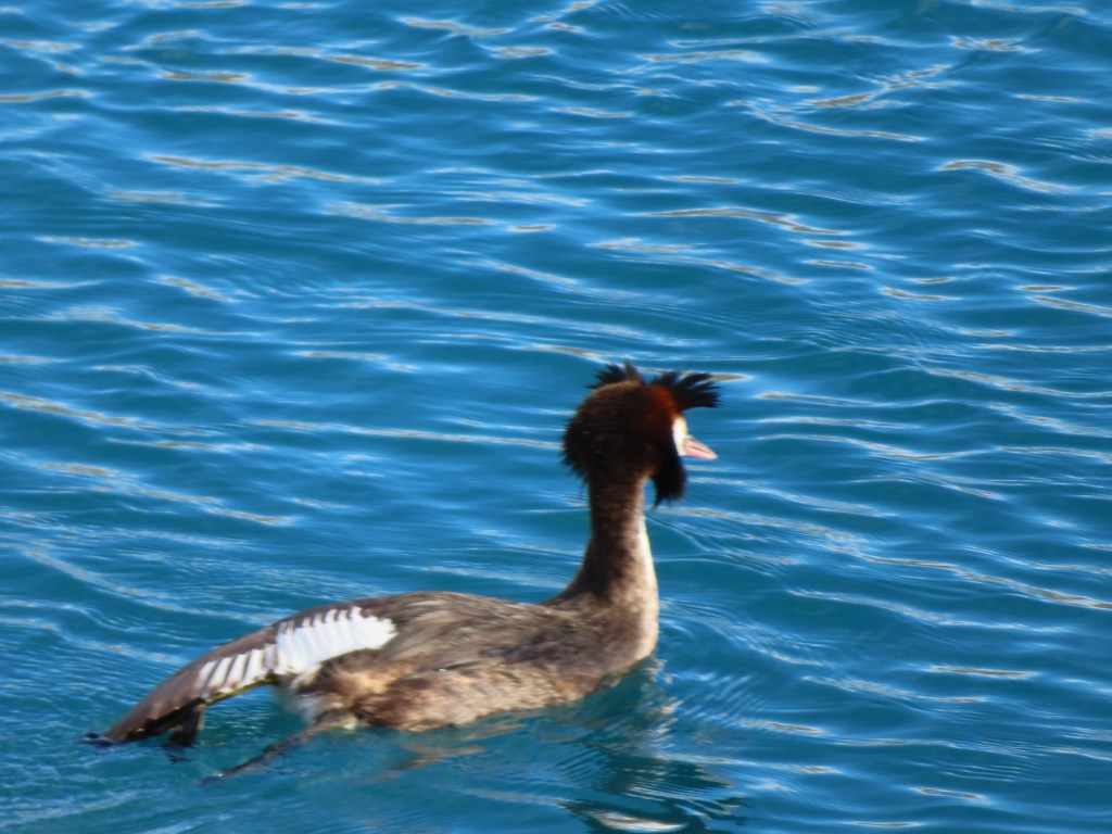
There were also birds called the Australasian crested grebe. They seem to spend quite a bit of time floating around with their heads buried in their wings. When they are awake they have a little crest on each side of their heads. They also dive for fish, weed, snails etc.
It was a relaxing time at the canals, and after a wet night we decided to get on the road again, destination unsure but possibly Omarama.
The weather forecasts were predicting a few days of bad weather so we had some choices to make. I can never go past Ashburton without stopping, so we decided to spend two days there instead of one. As it turned out, the weather wasn’t as bad as predicted but never mind. Ashburton has several attractions: one is the lovely dog park; another is the Ashburton Mill House – home to local yarns, and spinning wheels and weaving looms manufactured in the adjacent factory. This complex is right next door to where the flour mill used to be, that I visited regularly as a part of my role working for River Milll Bakeries. It burned down not long after the company sold it. The tall flour loading building remains. The Mill House was once lived in by the Head Miller, but was handed over to be used as a cafe and retail outlet for wool and spinning wheels etc. many years ago.
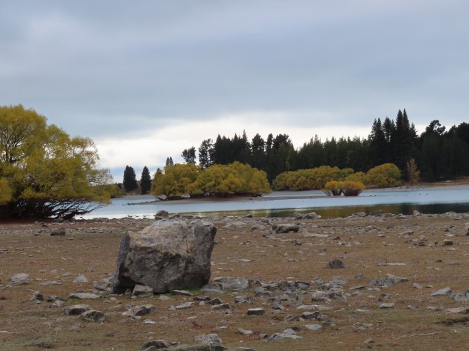
Once the weather system started settling, we headed on towards Tekapo, an area I just love. The motorhome park there is wonderful and we got a parking spot looking at the Lake. It is a shame to see the Lake even lower than it was the last time we were here.
There are lots of walks around here, and an extensive dog park right next door.
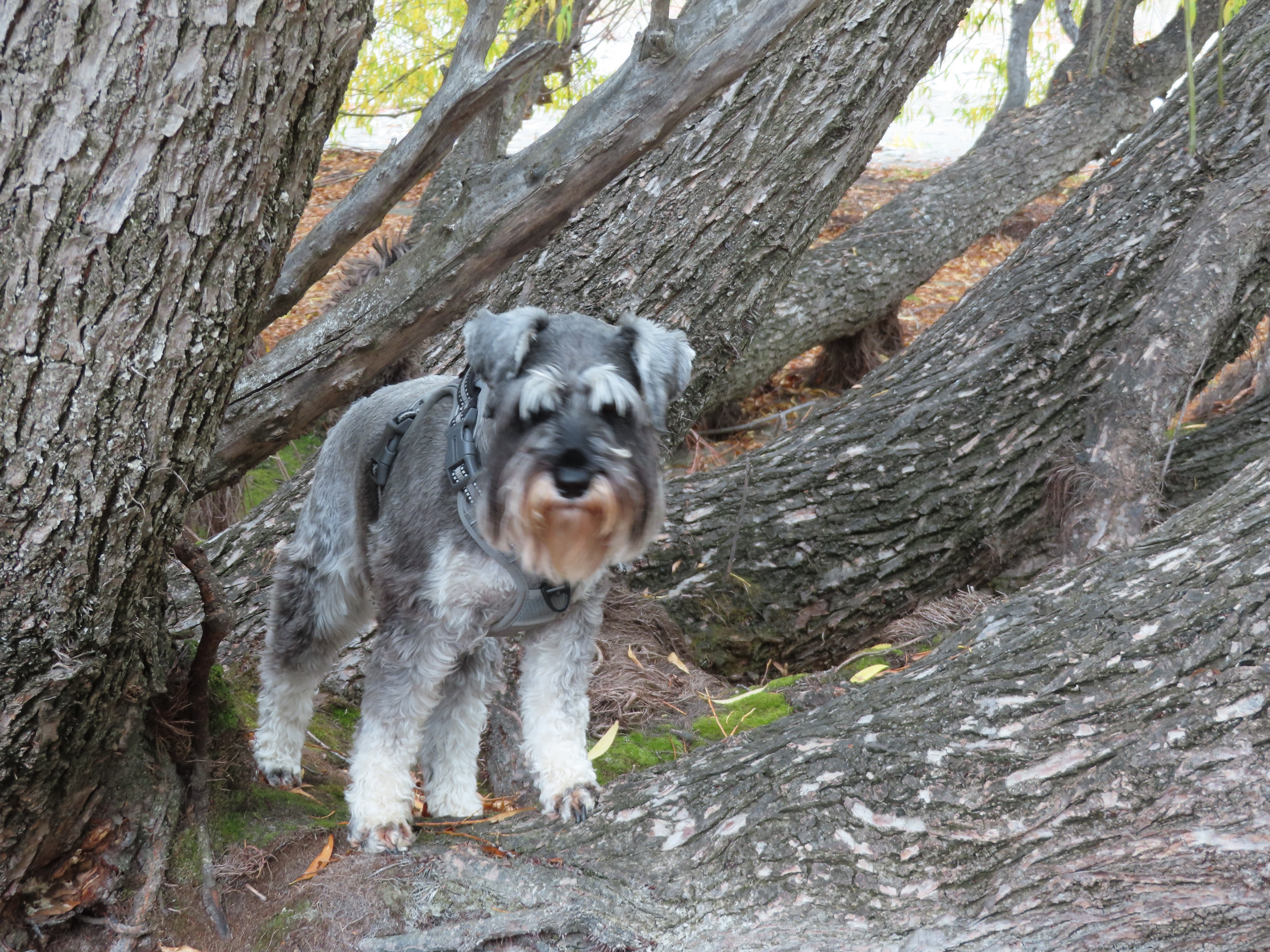
It was great for the dogs to be able to run free and meet other dogs. Beau is a very social little dog who loves to play with other dogs, as long as they don’t touch his bum! There are huge pine trees here, that drop huge pinecones, but don’t pick them up because they have needle like spikes all over them!
The dogs had at least 2 walks per day through the dog park.
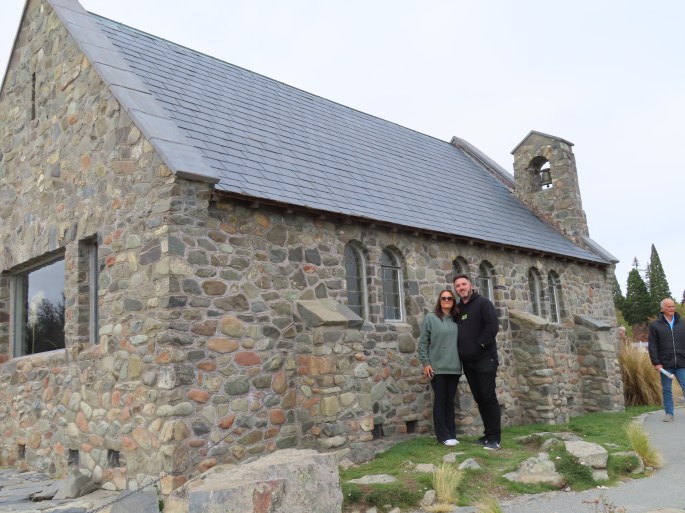
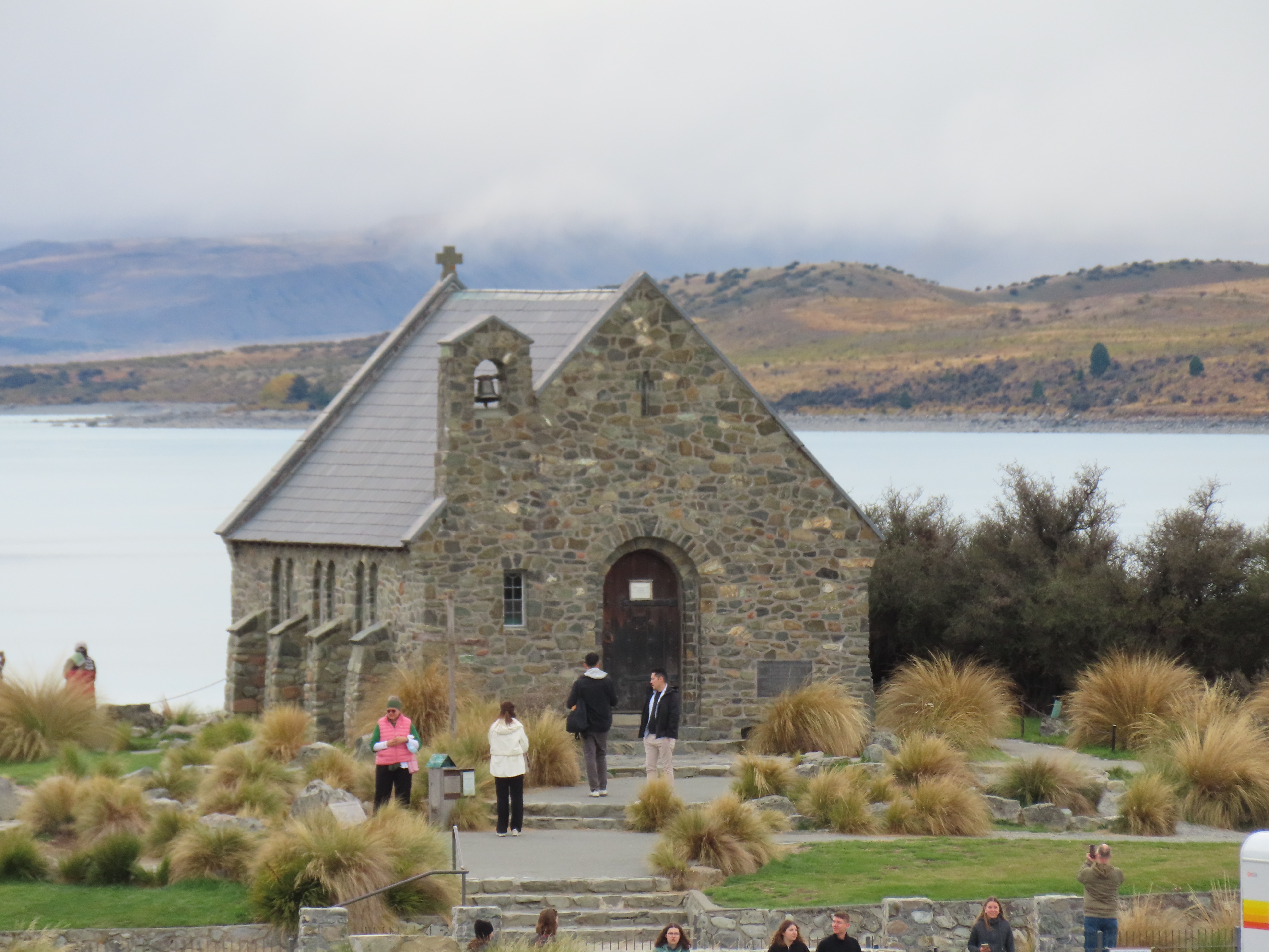
The next day we met Ben (my son) and Karina (his wife) in the township of Tekapo. They had hired a motorhome from Christchurch and were enjoying a short time away on their own, for their wedding anniversary. Together we wandered around the Church of the Good Shepherd, and the area around it, and then had morning tea together. I would have to say that the tourism industry is booming – very hard to get a photo without tourists in it. I was again struck by how “self entitled” the Asians are in general. They will push in front of you, never consider moving aside for you, and won’t even move over to let you pass on the footpaths.
All too soon they were off, heading towards Omarama, while we decided to stay one more night before heading off southwards. It was a shame the weather didn’t completely clear. We had the odd shower, but even when it was fine, the cloud clung to the hills, preventing us from seeing the spectacular mountains behind the Lake.
We left our park in Cass quite early the next morning which is unusual for us. We decided to head to the lookout of Arthur’s Pass because we were so close, and then come back out east again.
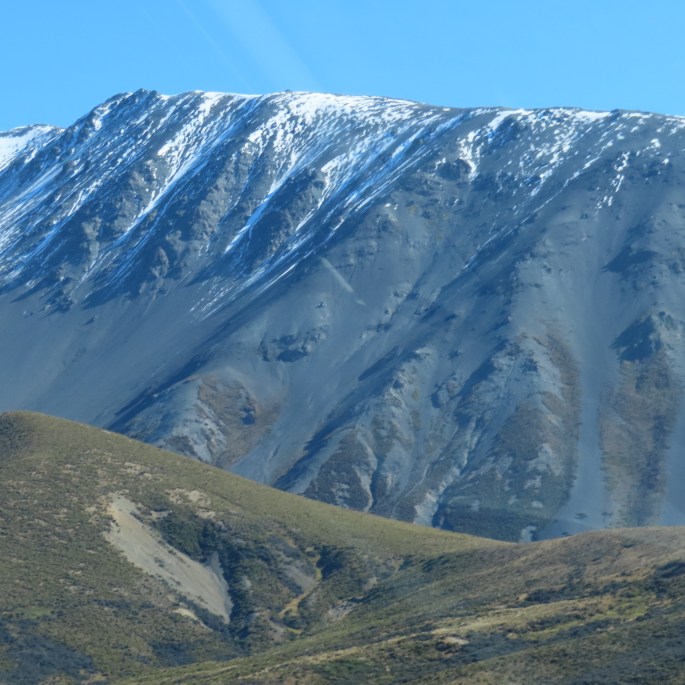
The terrain here is very steep and incredibly shingly. I am sure these peaks must lose some of their altitude each year when the snow melt washes some of it away.
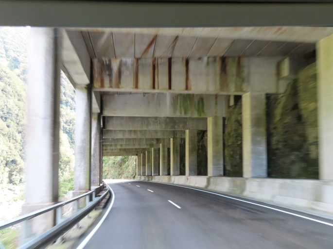
We stopped at the lookout over the half tunnel which protects the main road from falling rocks. There are usually kea here which Bruce was already starting to moan about, (but I was secretly hoping they would be there), but not today.
We had to do the obligatory stop at the Otira Hotel. I would have to say it needs a bit of tender loving care. The scones with butter and jam were just as before, but some of the antiquities look neglected.
We started to wend our way back east but stopped in along the way for a look at Lake Lyndon. Although the wind was getting up a bit it was still lovely.
Further on from there, just before Castle Hill we came across a sign for Cave Stream and decided to call in for a look. Once again, it is run by DOC and there was a lovely carpark area and nice paths.
Cave Stream is also a limestone area and the views are wonderful.
The stream runs beneath steep limestone banks, and at the lookout there is no sign of a cave at all – just a little wooden gate with a steep, narrow muddy track leading down to the stream at the bottom. Of course we just had to have a look. It was a careful walk downwards. A steep drop on one side and a narrow and slippery track increased the nervous tension. Part way down the track we could see the cave, and it became apparent that Cave Stream has that name because the stream runs through the cave, and we would have to walk through the stream to get to the cave! We were not wearing tramping shoes so realised that probably wouldn’t be a good idea for us. I slipped at one stage so it wasn’t long after that we decided to head back.
It was a bit disappointing, but we have to be sensible occasionally. We took it slow and easy coming back up, with a few stops for me to catch my breath, but it still felt good.
This time we headed towards Ashburton – a frequent stop over for us and a safe place to wait out the coming storm.
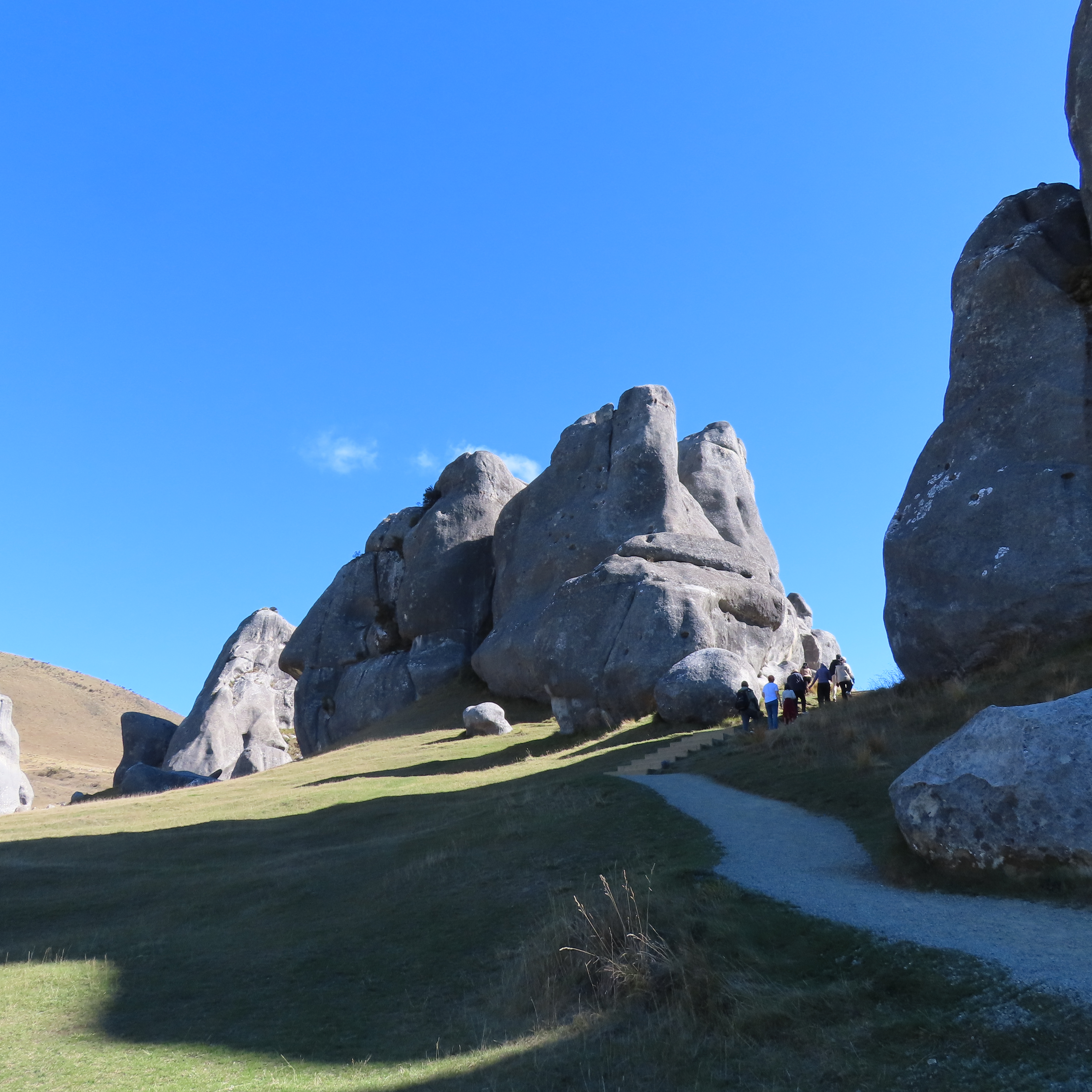
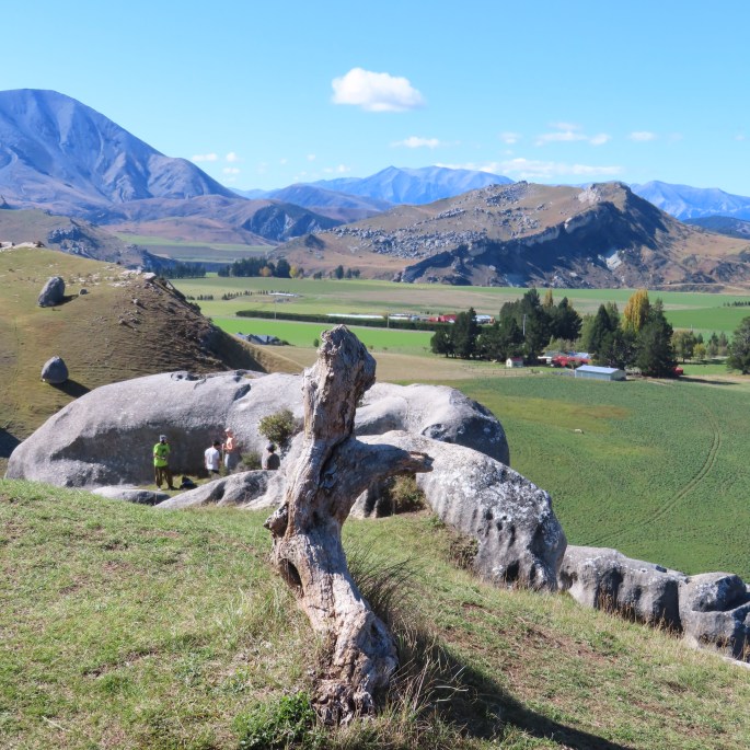
Castle Hill is about 98 kilometres from Christchurch, off Arthur’s Pass. The drive is scenic, first with the rolling farmland outside Christchurch, and the further away from Christchurch we got the more dramatic the scenery became with mountain peaks in the distance.
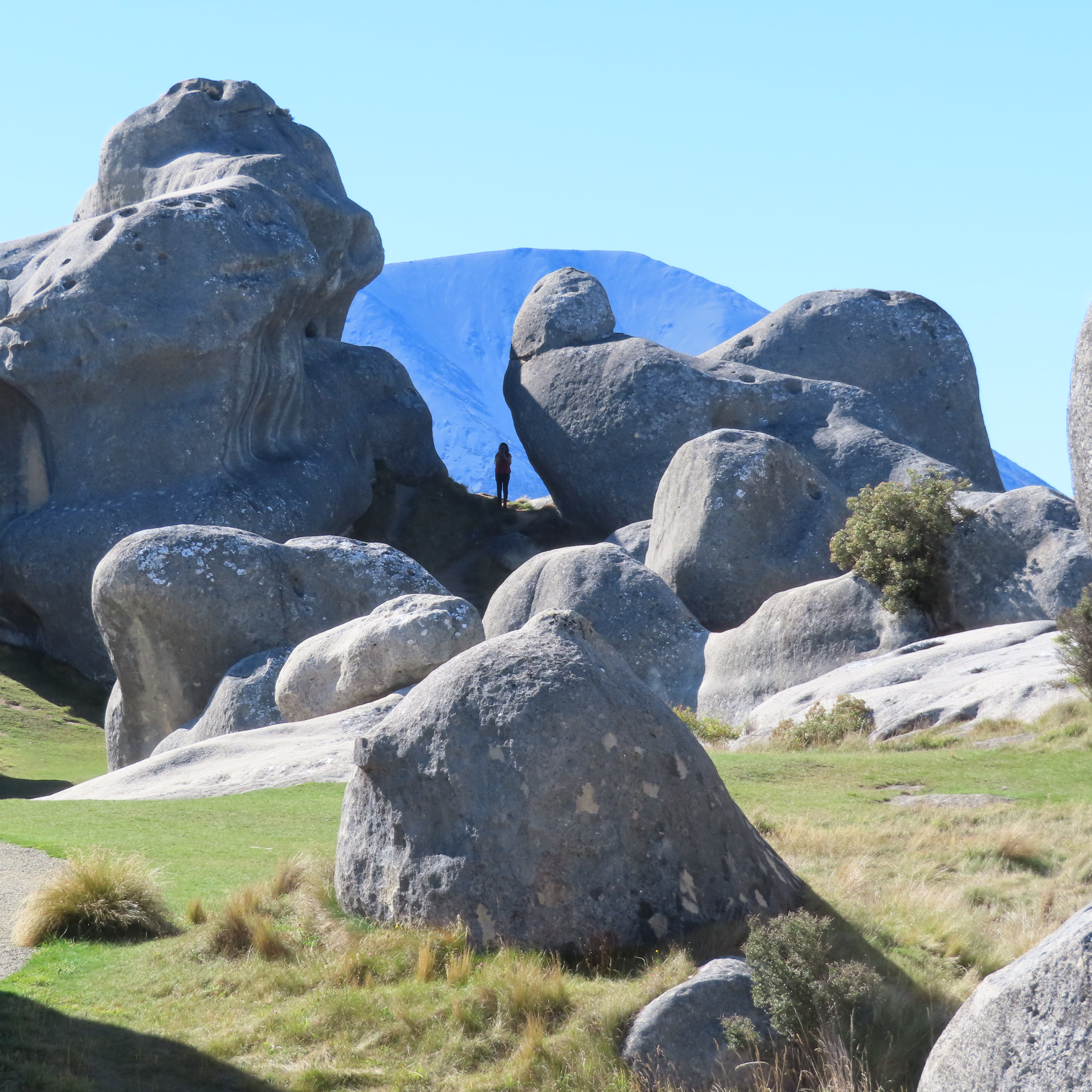
What I did not expect from Castle Hill Rocks, was how well it was set up for tourists. It was a weekend day, in the school holidays, and a beautiful day as well, so there were visitors a plenty.
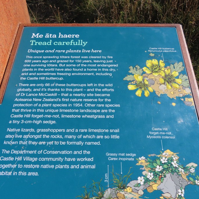
Castle Hill Rocks is managed by the Department of Conservation and it is a precious site to local Maori. Both parties are actively working to restore native plants to the area, such as the Castle Hill buttercup, which has become quite rare.
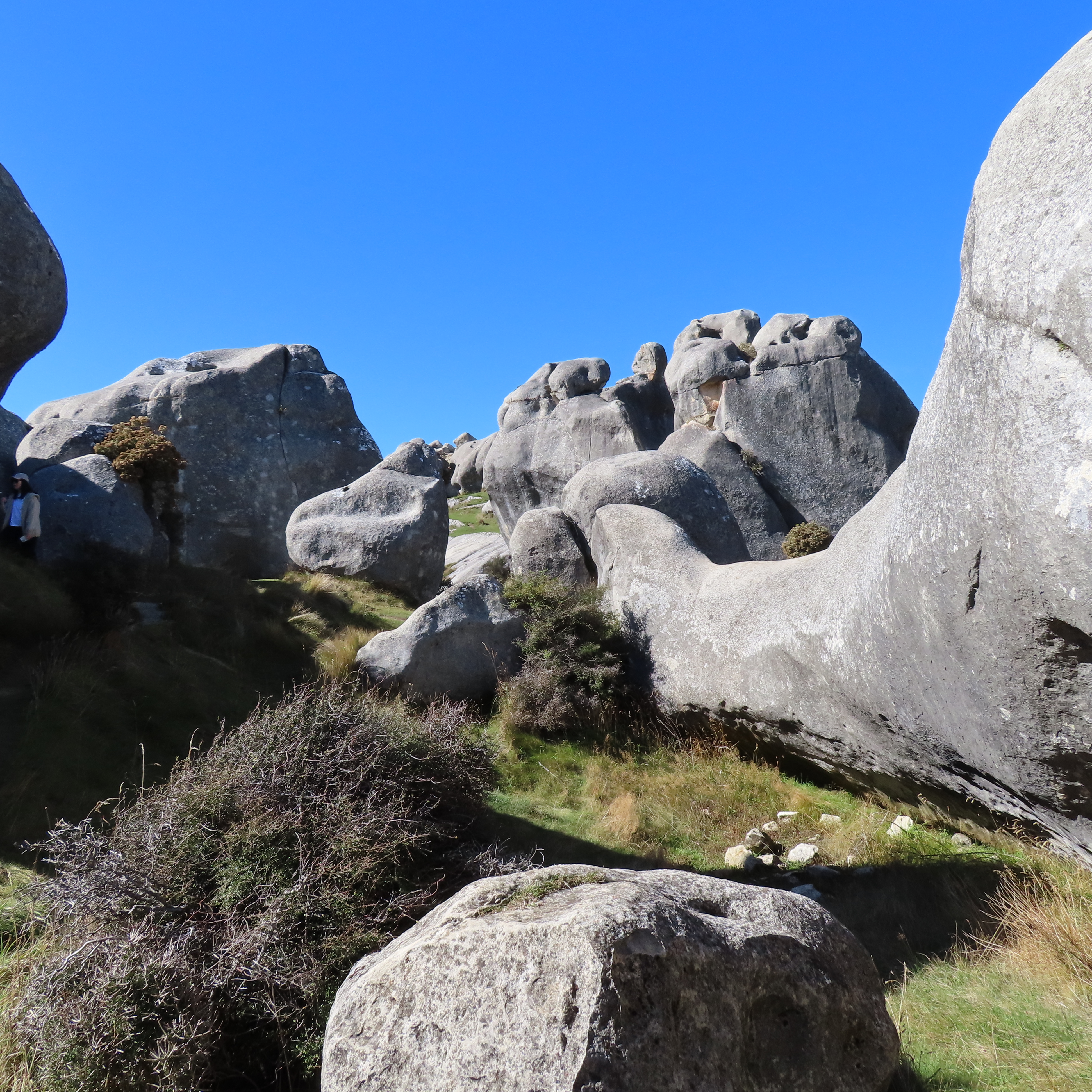
Even though this site is in the middle of the mountains, it was reportedly once the sea bed over 300 million years ago which, through the shifting of tectonic plates and faultlines, has been thrust skywards. The rocks are towering blocks of limestone in all shapes and sizes, fashioned into these shapes by rain, wind and, long ago, by the sea.
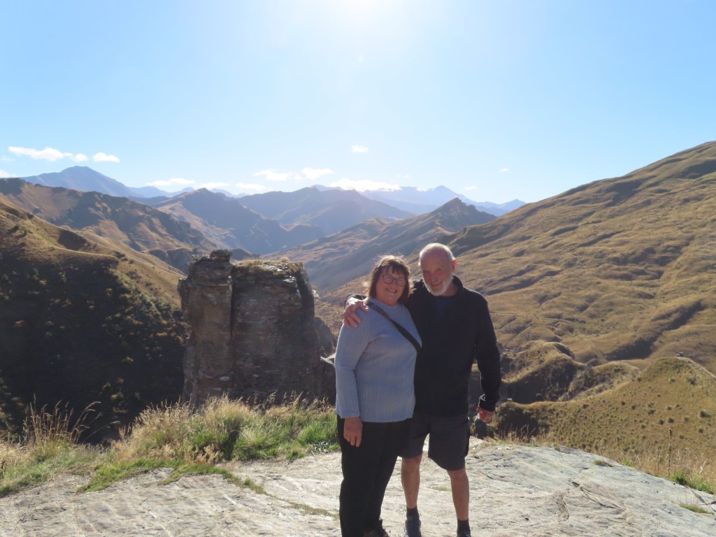
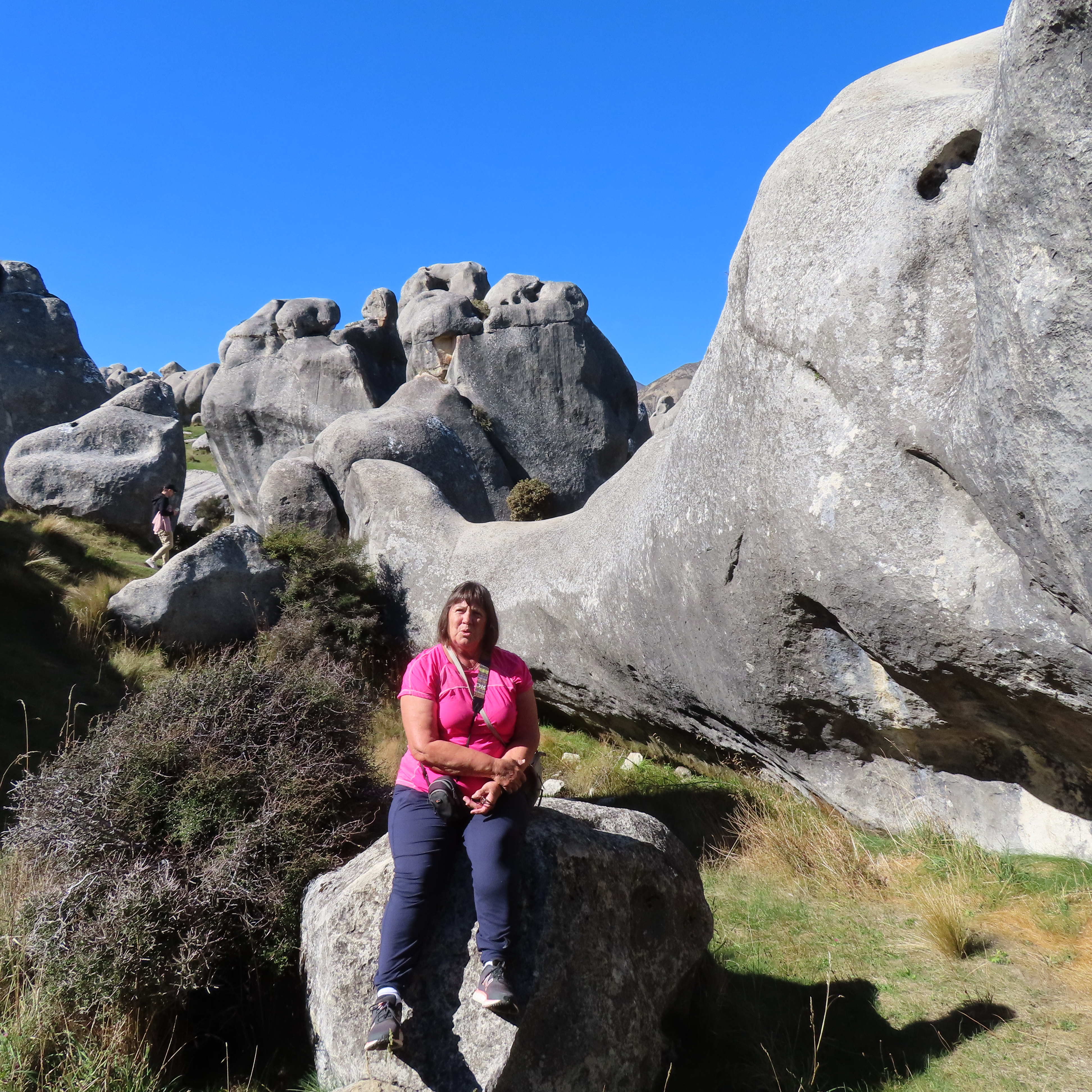
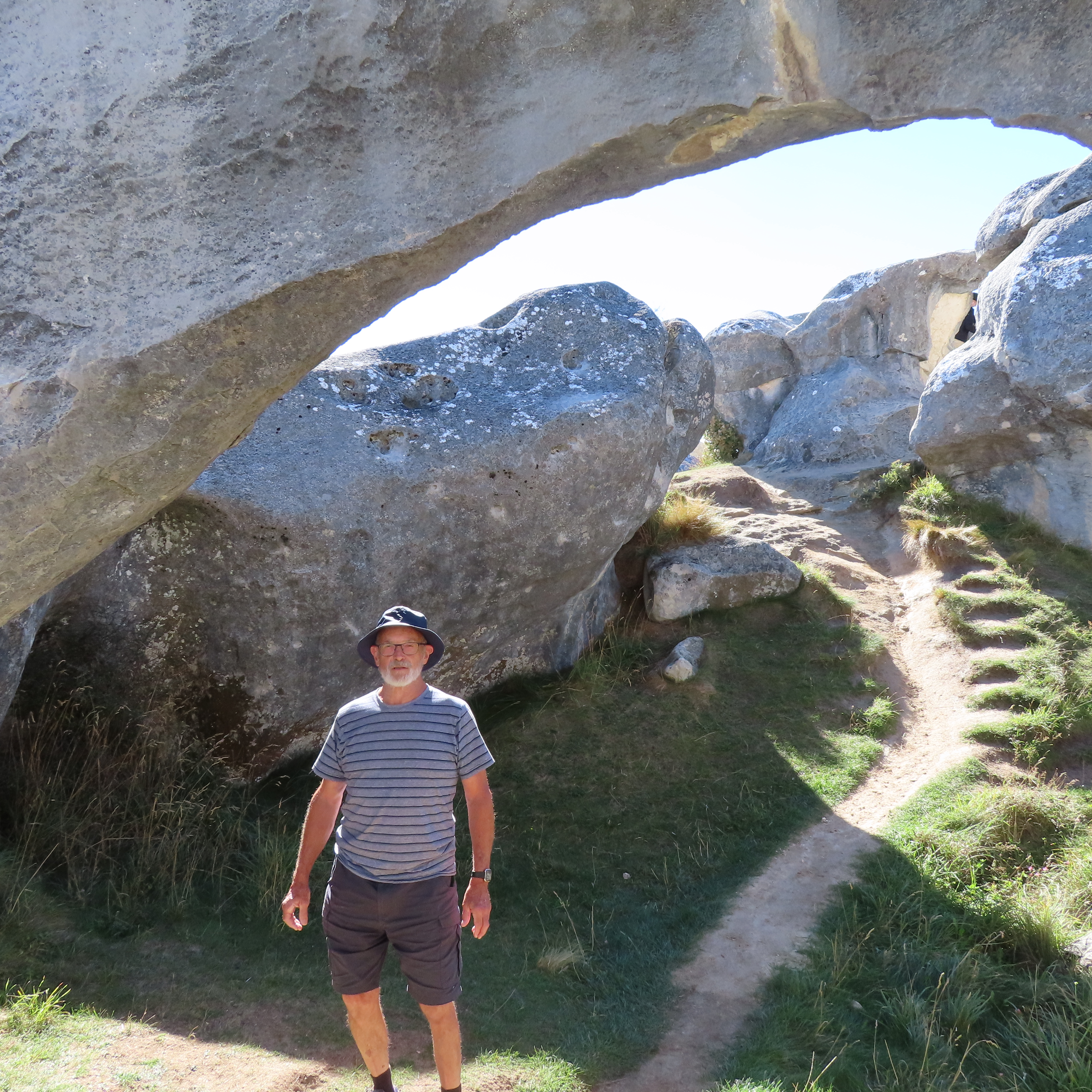
Bruce and I had a wonderful time wandering around these monoliths. I also enjoyed the seeing the number of young people who came here to practice their climbing skills. They lugged their padded falling mats up here with them. We came across a couple of girls who found the climbing a bit tough, so were using their mat as a picnic blanket!
We wandered around for quite some time, and didn’t really notice how high we had come. Our motorhome is down there somewhere.
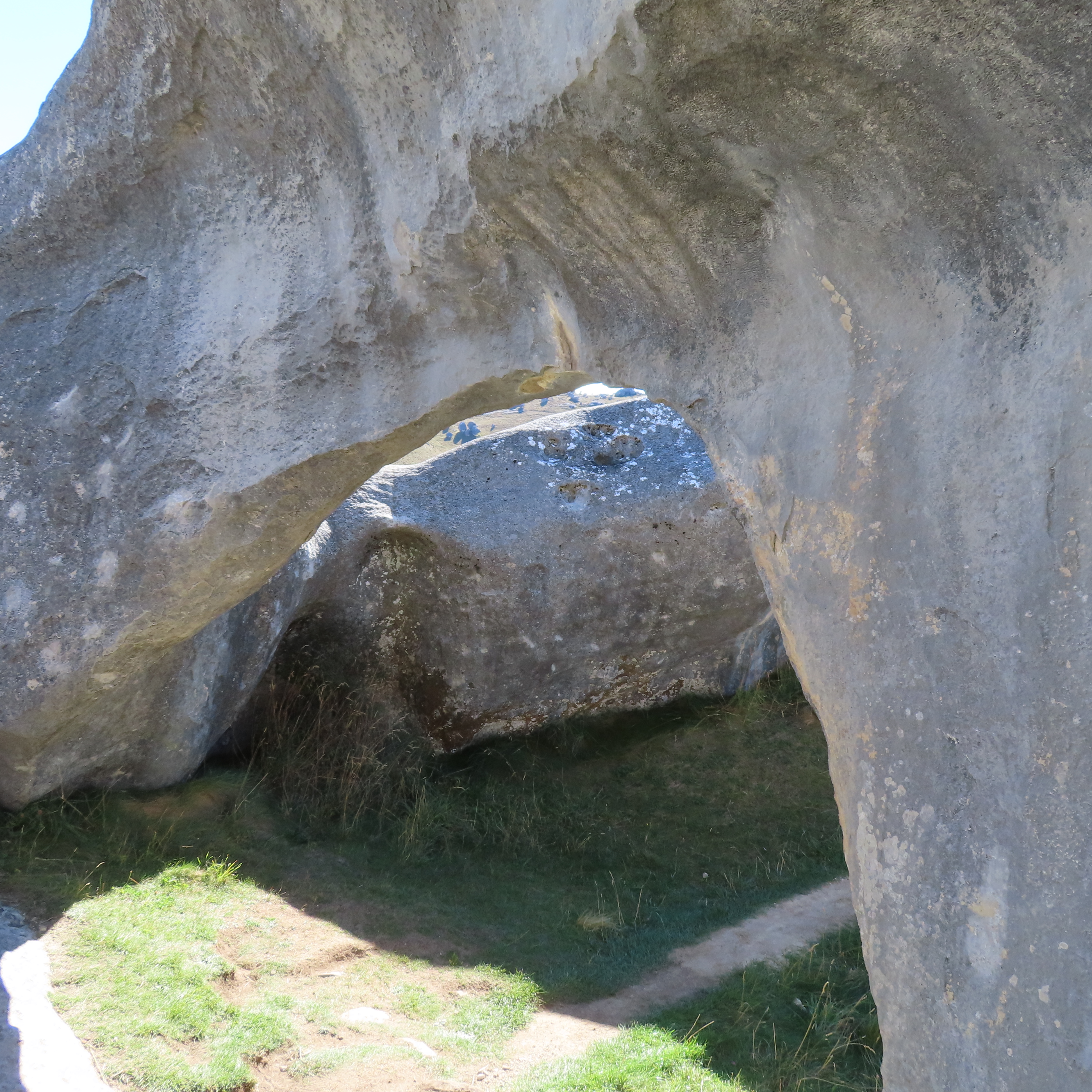
When it came time to go down, the area we were in only had the narrowest of tracks and it looked a bit precarious. I am fearful of falling and breaking a hip so elected to slide down on my bum. That was a lot of fun – the grass was slippery so I was able to get up a bit of speed. I only hope no-one was watching this crazy 70 year old sliding down the hill on her butt. When I got to my stopping point, near a more substantial track, I looked back to see Bruce still working his way down on all fours, and going backwards, looking a bit like a crab.
You can see the way the land was thrust up at an angle in the photo above.
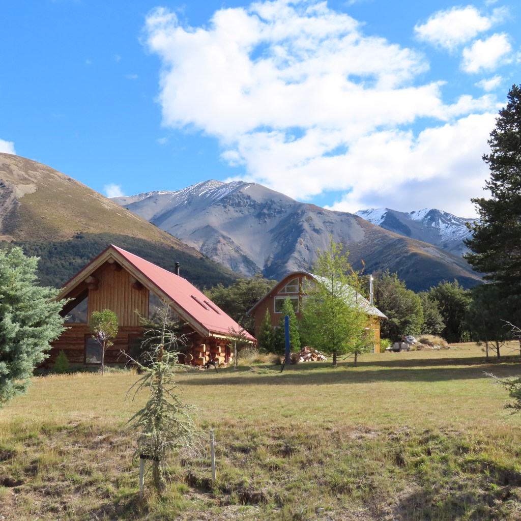
Once back at the motorhome we headed back on the Arthur’s Pass road, and headed into the alpine Castle Hill Village. This was a well set up little village of mountain style cottages. Presumably people come to stay here for the hiking and skiing. A charming little place.
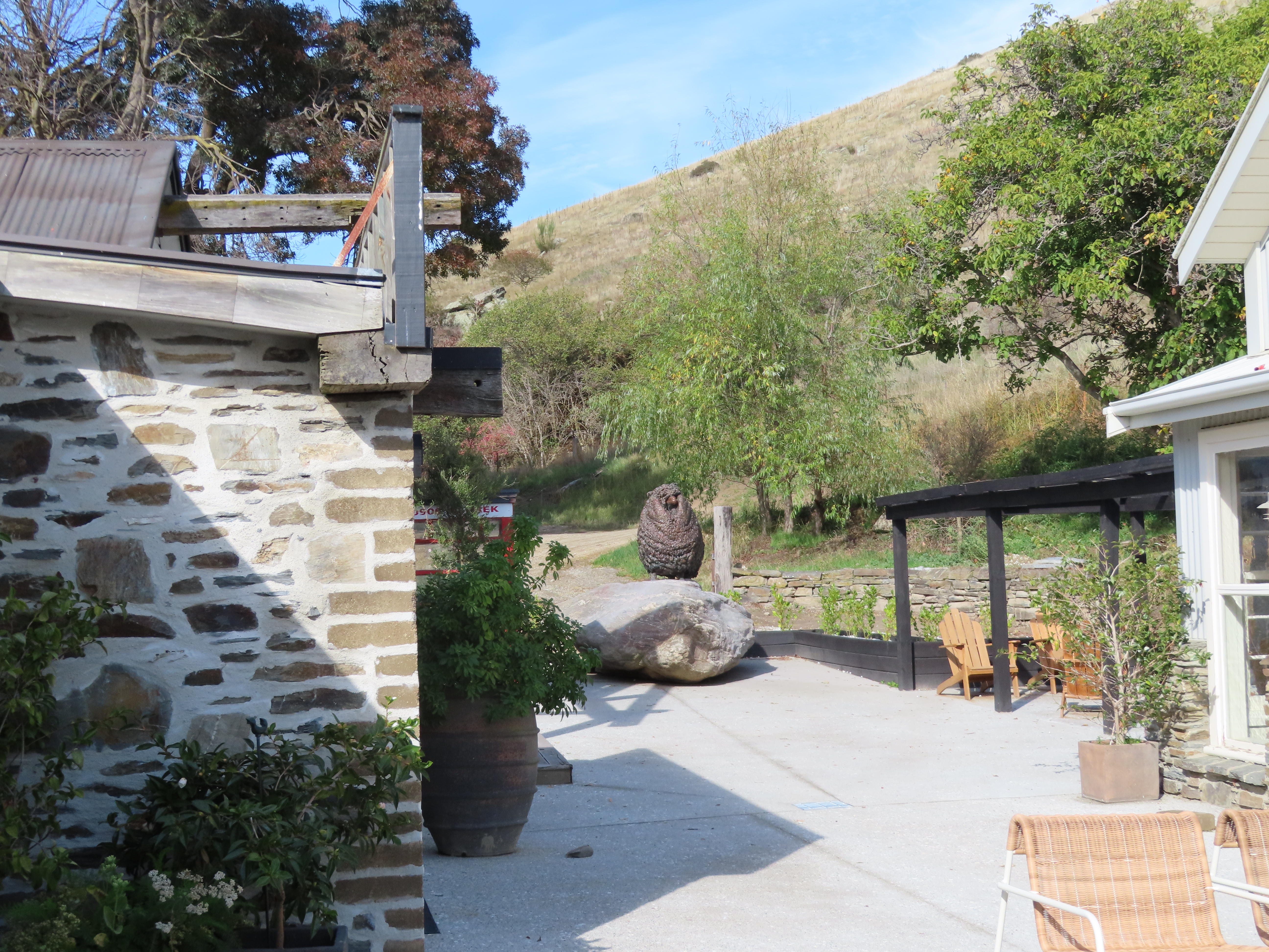
Our stop for the night was at a Park Over Property at Cass. This was really a collection of a couple of old railway cottages no longer required by the railway. We found that “happy hour” here was compulsory, and it was quite pleasant. It was a surprise to see that a couple who arrived after us where from our NZMCA area, and Coromandel town in particular – we knew each other!.
We had a peaceful night, and an early start the next morning trying to get sunrise photos on the mountains.
It was with great reluctance that we left Kaikoura to head south towards Christchurch. We were due to meet up with my cousin Sharon, and her husband Chris, on Wednesday, so we decided to stay in Amberley on Tuesday.
Amberley Beach is a short drive out from the town centre, and even though we had been there before, we decided to go again. Time has not been kind to this area. Firstly, it is evident that erosion has been a significant problem. We could see where huge shingle barriers had been built to try and keep the sea at bay. The beach is steep shingle so not easy to walk on. It didn’t take us long to decide to walk along the sea wall instead.
The other thing we noticed was the very poor standard of housing, including some living fulltime in their vehicles in the camp ground. We did not feel comfortable being out of sight of the motorhome.
We drove out to the golf course, and it looked like the sea had washed part of this access road away, and what was a narrow tar sealed road is not a very rough shingle stop bank. Here there is a bit of an estuary which has a pleasant walk around it, and we did a bit of that before driving back into town.
We decided to stay at a Park over Property for the night called Hannah’s Haven and it was charming.
The property is not far back from the main road, but you wouldn’t know it – it was very quiet. The man who owns it was a civil engineer who came to the area to work after the earthquake. It was supposed to be a temporary move but became permanent. His wife is a keen gardener and told me that they have a little micro-climate there. They are usually 2-3 degrees warmer than Christchurch, and see only 3-4 frosts a year. Her roses are still blooming when she goes to prune them in July.
The next day we headed into Christchurch. We had a bit of running around to do before heading to Sharon’s, and we did what we could before driving in Sharon’s gate – which requires precision driving!. Uncle Ron also came to dinner and it was nice to see him again too. Unfortunately, his memory isn’t improving, but he is still managing to live at home on his own, and he is pleasant company. On both nights, Sharon and Chris presented us with gourmet meals and their hospitality is boundless.
I spent the next day working from the motorhome, taking advantage of their broadband. I seem to have acquired an email marketing job which still needs to be plugged away at while we are away.
Friday was our last day in Christchurch, and we navigated the city centre to go to Ravenscar House and gallery, as recommended by my friend Jenny. The huge house was built from rubble from the previous house which had to be destroyed after the earthquake. There are a lot of original artworks and antiquities in the house including 3 Goldy paintings, several Frances Hodgkins and several Colin McCahon, and a couple from Rita Angus – all pioneer artists of New Zealand. Bruce, being the lovely man that he is, commented that my art was better than many of the paintings we saw!
We spent one more night in Christchurch before heading in the direction of Arthur’s Pass.